![Philippine Islands. In Luzon and Mindanao names in this type: Morong indicate Spanish subdivisions into provinces. [inset:] Manila Bay Showing Dewey’s Line of Advance and Battle Movements. Alaska and Part of British America The Yukon Gold Fields and routes by which they are reached [verso]](https://galleryofprints.shop/wp-content/uploads/2026/04/jo65254-Philippine-Islands-CK-1899-recto-scaled1.webp)
![Philippine Islands. In Luzon and Mindanao names in this type: Morong indicate Spanish subdivisions into provinces. [inset:] Manila Bay Showing Dewey’s Line of Advance and Battle Movements. Alaska and Part of British America The Yukon Gold Fields and routes by which they are reached [verso] - Image 2](https://galleryofprints.shop/wp-content/uploads/2026/04/jo65254-Alaska-British-Columbia-CK-1899-verso-700x472-1.webp)
Description
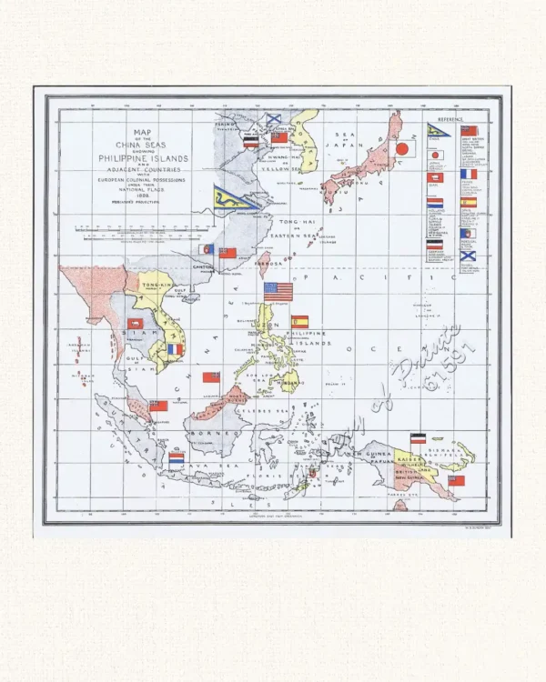
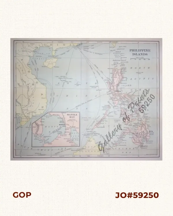
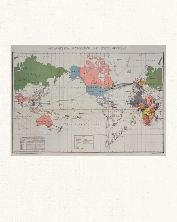
Original-colour lithograph; With printed note on Alaska map: The boundary here shown between Alaska and British Columbia is that finally agreed on by the Alaskan Boundary Commission in October, 1903.
In the late 1800s and early 1900s, American publishing experienced rapid expansion, giving rise to new mapmakers who produced visually appealing and highly accurate maps capable of competing with the best of their contemporaries. This particular map originates from a collection issued by one of the era’s smaller publishers and exemplifies up-to-date information paired with high-quality craftsmanship. Its vibrant colors and meticulous detail distinguish the maps in Crowell & Kirkpatrick’s Peerless Atlas, making them an excellent addition to any collection. [online quote]. Unidentified cartographer.
![Typus freti Manilensis detroit de Manilles [Straits of Manila]](https://galleryofprints.shop/wp-content/uploads/2015/05/JO54051-Renneville-1725-Philippines-Manila-Samar-Mindoro-Luzon-scaled-1-600x750.webp)

![The National Geographic Magazine, vol.XXIII, July, August, September, October, November, December. [including:] vol. 9 [contains] Head-Hunters of Northern Luzon](https://galleryofprints.shop/wp-content/uploads/2026/04/jo12865-National-Geographic-front-scaled1-600x750.webp)
![Chicago Daily Tribune broadsheet Thursday, Sept. 28, 1944 Pacific Island Stepping Stones to Japan [verso ads & articles]](https://galleryofprints.shop/wp-content/uploads/2026/04/jo65220-Chicago-Daily-Tribune-broadsheet-1944-map-verso-scaled1-600x750.webp)