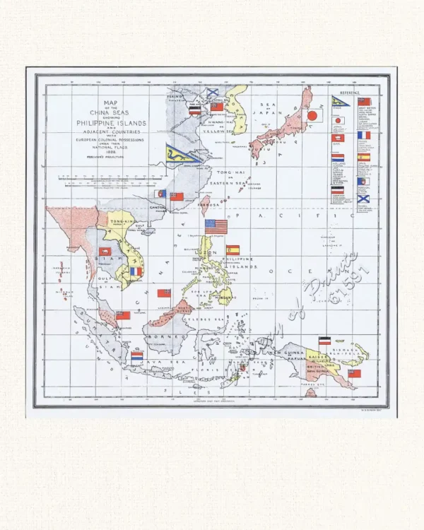
Description
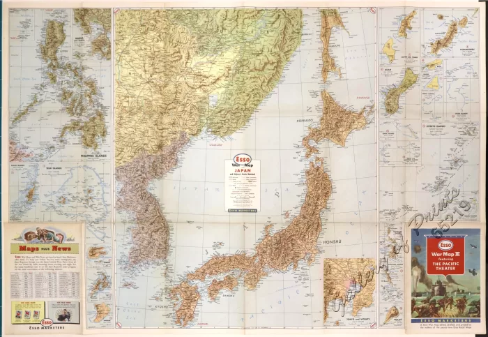
RARE Original-colour Esso War Map III highlighting the Pacific Theatre, printed in the 1940s during the peak of World War II. These maps were handed out at Esso gas stations as a way to help Americans track the progress of the conflict across the Pacific region. Features a full map of the Southeast Asia region (on recto) and Japan and Adjacent Asiatic Mainland (on verso), with insets of the Philippines, Manila, South China Coast Canton-Hong Kong Area, Formosa, Vladivostok and vicinity; Tokyo and Japan’s islands on the East China Sea and Pacific Ocean; Palau Islands, Truk Islands, Dublon Island, Yap Island, and Angaur Island. The Pacific War (also referred to as the Pacific Theatre) was fought between the United States and its Allies against Japan from 1941 to 1945, beginning after the Attack on Pearl Harbor and ending in 1945 following the atomic bombings of Hiroshima and Nagasaki by the Americans, which led to Japan’s surrender and the conclusion of World War II. [Wikipedia]
![Plan du Port de Subec, en I'Isle de Lucon [Plan of The Port of Subic on Luzon Island]](https://galleryofprints.shop/wp-content/uploads/2015/05/JO55439-de-Mannevillete-c1775-Plan-du-Port-de-Subec-600x750.webp)
![Scorpæna Scorfa. [Red Scorpionfish] Der grosschuppige Drachenkopf. La Crabe de Diarrits. The poisonnet Grooper.](https://galleryofprints.shop/wp-content/uploads/2024/11/JO65056-Bloch-1786-Scorpaena-Scorfa-600x750.webp)
![The National Geographic Magazine, vol.XXIII, July, August, September, October, November, December. [including:] vol. 9 [contains] Head-Hunters of Northern Luzon](https://galleryofprints.shop/wp-content/uploads/2026/04/jo12865-National-Geographic-front-scaled1-600x750.webp)
![Chicago Daily Tribune broadsheet Thursday, Sept. 28, 1944 Pacific Island Stepping Stones to Japan [verso ads & articles]](https://galleryofprints.shop/wp-content/uploads/2026/04/jo65220-Chicago-Daily-Tribune-broadsheet-1944-map-verso-scaled1-600x750.webp)