Antique Maps 42
Showing all 5 resultsSorted by latest
-
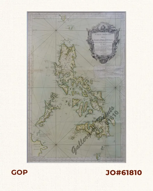
Carte Reduite des Isles Philippines pour servir………
-
![PHILIPPINES [SOVIET RUSSIAN MAP] 1:3 000 000. Second Edition. Main Department of Geodesy and Cartography under the USSR Council of Ministers. Moscow, 1967. insets: 1) Economic Map. Scale: 1-6 000 000; 2) Map of Peoples. Scale: 1-6 000 000; 3) Annual Rainfall. Scale: 1-10 000 000](https://galleryofprints.shop/wp-content/uploads/2018/09/jo61526-Russian-1967-Philippine-map-scaled-1-600x750.webp)
PHILIPPINES [SOVIET RUSSIAN MAP] 1:3 000 000. Second Edition. Main Department of...
-
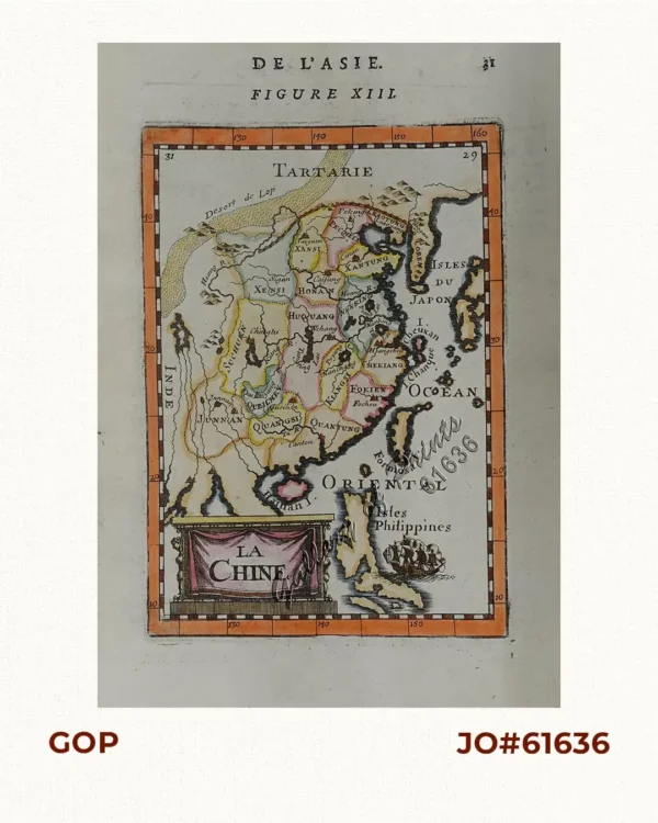
La Chine (China)
₱13,200.00 -
![A New Chart of the China Sea, and East India Archipelago. Comprehending the Sunda Molucca & Phillippine [sic] Islands in which are exhibited the various Straits and Passages to Canton, and between the Indian & Pacific Oceans; carefully drawn and regulated according to the most Approved and Modern Surveys, and Astronomical Observations, by J.W. Norie, Hydrographer.](https://galleryofprints.shop/wp-content/uploads/2018/09/jo58951-Norie-1821-A-New-Chart-of-the-China-Sea-Philippine-Islands-scaled-1-600x750.webp)
A New Chart of the China Sea, and East India Archipelago. Comprehending the Sund...
-

Carte de la Mer de Chine… par M. Daussy,… capitaine Horsburgh… Sous le Min...
₱166,000.00