Description
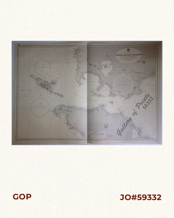
lithograph. Map#3817. Small corrections 1937[many subsequent years stated till] 1966 – Z.4-65. Seal of the Hydrographic Office – 3 Sea Roses with 360 degrees.
₱11,000.00
Author: not indicated
Publisher: Admiralty London, 6th Nov. 1936 under the Superintendence of Rear-Admiral J.A.Edgell, C.B., O.B.E., Hydrographer.
Year: 1966 [1937]
Size: 98.9 x 66.2 cm
1 in stock
lithograph. Map#3817. Small corrections 1937[many subsequent years stated till] 1966 – Z.4-65. Seal of the Hydrographic Office – 3 Sea Roses with 360 degrees.
with center fold as issued.
![Ung habitant de lysle Capul [A native of the island of Capul] [first despiction in print of a Filipino]](https://galleryofprints.shop/wp-content/uploads/2024/05/JO64472-van-Noort-1646-A-native-of-the-Island-of-Capul-600x750.webp)