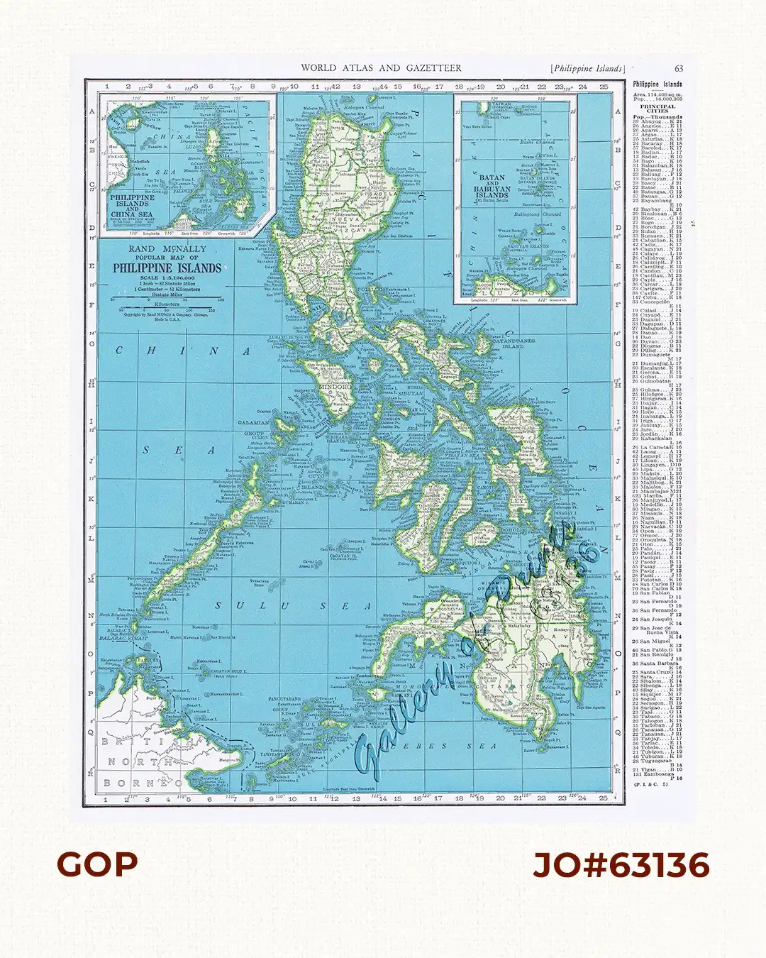
Description
original-colour lithograph with a column listing area and population at right side. verso: Rand McNally Popular Map of Puerto Rico. Vintage map from ‘World Atlas and Gazetteer’, p. 63
published by Rand McNally & Co., Chicago, during WW II.
![Plan des principaux ports de la côte d'Illocos … [Map of the Principal Ports of the Ilocos Coast]](https://galleryofprints.shop/wp-content/uploads/2024/07/JO62314c-Mannevillette-1775-Plan-des-principaux-ports-scaled-1-600x750.webp)