Description
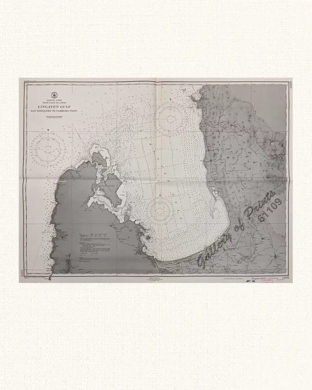
RARE lithograph map #4209, seachart published at Washington, D. C. 4th edition Mar. 1924 – 1st edition 1905 by U.S. Coast and Geodetic Survey, R. F. A. Studds, Director.
with stamp dated Jan 1 1951.
Corrected through Notice to Mariners No. 52, Dec 29 1951, U.S. Navy Hydrographic Office. with “24-3/21; 28- 5/12; 31- 4/30; 40- 7/9; 43- 8/31; 45- 3/31, 9/15; 47-9/22; 48- 1/19; 49- 7/4; 50- 12/25”
![Islas de Infanta y Polillo pl. 12 [Quezon Prov., Polilio Is., Pananongan I., Jomalig I.]](https://galleryofprints.shop/wp-content/uploads/2023/08/JO62585-Algue-1900-Quezon-Province-Polilo-Jomalig-Patnanongan-scaled-1-600x750.webp)
![La Isla de Biliran (Filipinas) y sus Azufrales [por D. Enrique Abella y Casariego del cuerpo de ingenieros de minas]](https://galleryofprints.shop/wp-content/uploads/2016/07/jo12033-Abella-y-Casariego-1885-La-Isla-de-Biliran-600x750.webp)