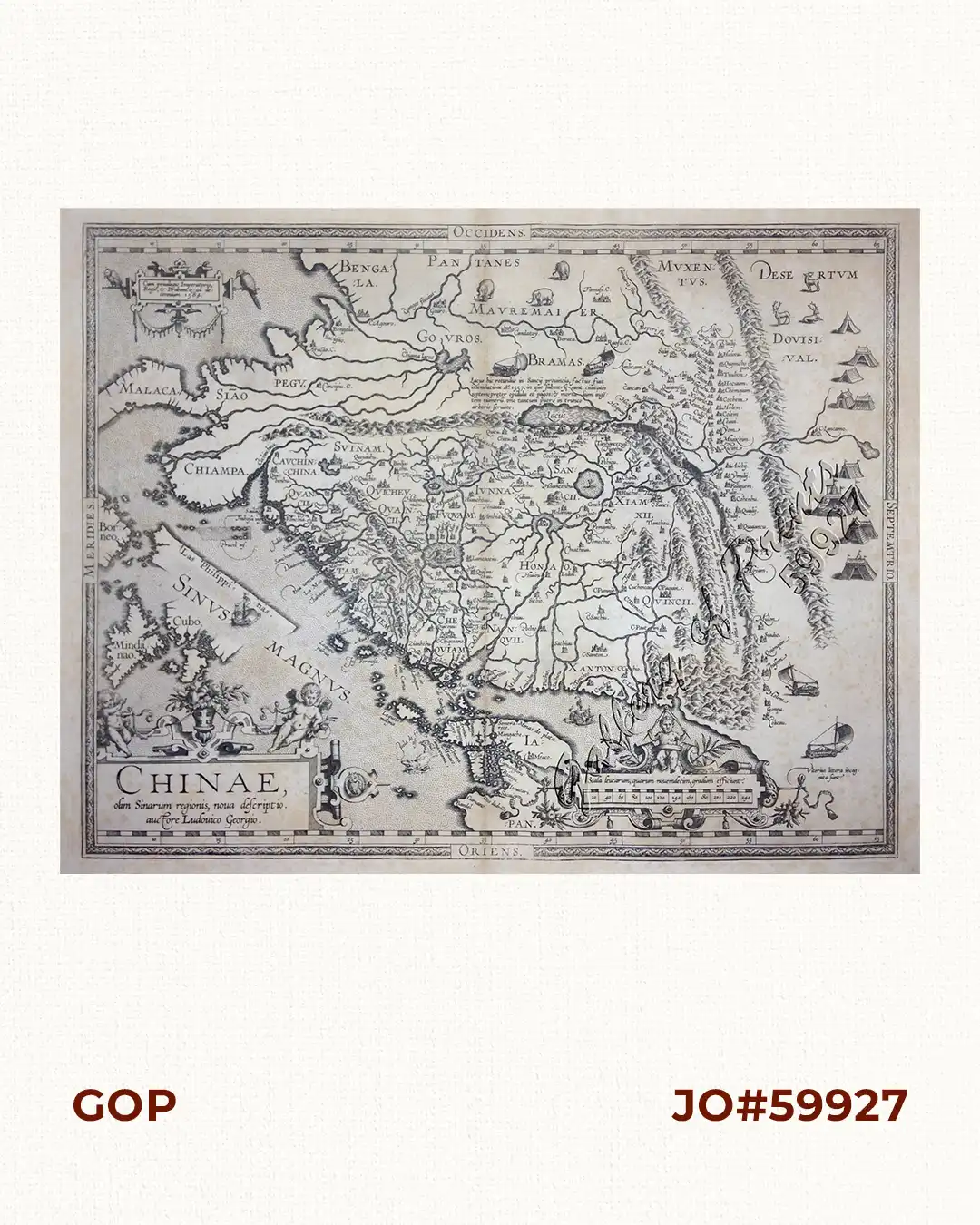
Description
copper engraving
this EXTREMELY RARE map from Theatrum Orbis Terrarum, Latin edition, pl. 93, published in Antwerp, was the first map
to focus on the entire China in a Western atlas, and showing surrounding areas of Japan, a very
near America and some islands of the Philippines, here in the 2nd state, mentioning “Las Philippinas”
on what is Palawan, depicted as a long, diagonal island just north of Borneo based on Portuguese sources.
Ortelius shows Mindanao, and some islands to the north, but only Cubo [Cebu] is marked.
Ortelius was a notable Dutch cartographer, and the publication of this atlas in 1570 marked an
epoch in the history of cartography. It was the first uniformly sized, systematic collection of maps
of the countries of the world based only on contemporary knowledge, thus the first modern atlas,
a term used only 20 years later by Mercator. The “Theatrum” was re-issued in 42 editions with
5 supplements in Latin, Dutch, German, French, Spanish, Italian & English between 1570-1612.
The protrusion initially called ‘Beach’ by Marco Polo, is shown South of “Java Major”, alluding to
that speculative “balancing landmass”: Australia.
![Isla de Luzon pl. 10, inset: Pto. de Banacalan [Marinduque] (Quezon [or Tayabas], Camarines Norte, Marinduque, Balegin [Balesin], Calbalete [Cagbalete]… )](https://galleryofprints.shop/wp-content/uploads/2023/08/JO64134-Algue-1900-Isla-de-Luzon-scaled-1-600x750.webp)
![Femelle du Calao, de I'Isle Panay [Visayan Tarictic Hornbill (Female)]](https://galleryofprints.shop/wp-content/uploads/2019/04/JO52393-Martinet-1770-86-Femelle-du-Calao-de-IIsle-Panay-600x750.webp)