Description
copper engraving.
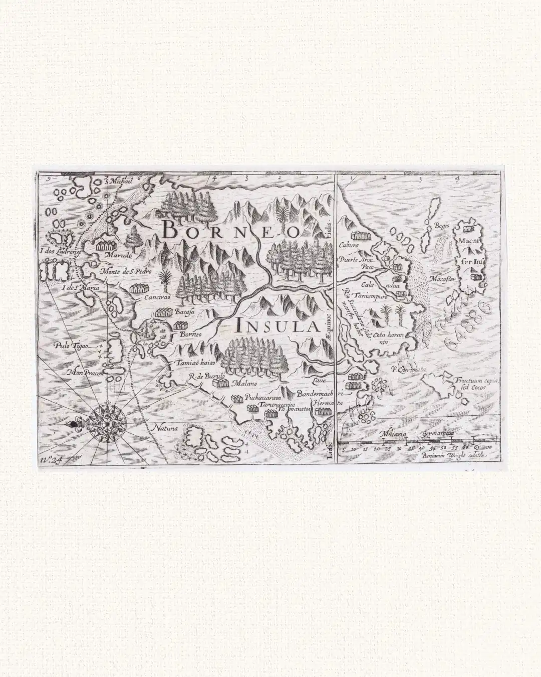
Map of Borneo first published by Cornelis Claesz in Amsterdam in 1602, to accompany Olivier van Noort’s account of his three year circumnavigation of 1598-1601). They were engraved by two of the foremost engravers of the day, namely Baptista van Doetecum and Benjamin Wright. Here the imprints are in final state, with numbers added in the lower corners, from Isaak Commelin’s 1646 “Begin ende Voortgangh of the VOC”, pl. 24.
This is the 2nd map of Borneo, only preceded by the 1598 Langenes map. North is at the left. South Borneo follows the Lodewijcksz chart of the first Dutch fleet of 1595-1597, published by Cornelis Claesz and that van Noort no doubt used on his voyage. North Borneo: Wright copied Plancius 1592-94 Spice map. The map shows the track of the ‘Mauritius’, coming from the Philippines, sailing along Borneo’s North coast, anchoring in Brunei Bay, and leaving through the “Gateway of Borneo” aiming for “the mainland of Malacca”, meaning present day Malaysia in December 1600. The most striking aspect of this mapping of Borneo is that the island’s east coast (top of map) is merely a hypothetical line. This conspicuous void in European knowledge of Borneo was a result of the route taken by early European mariners making the run between Malacca and the Spice Islands. Few of the places found on these earliest maps of Borneo were mentioned by subsequent visitors. One is Marudo, marking the bay at the northern tip of the island (upper left), a name which the bay has retained to this day (Teluk Marudu). Monte di S. Pedro is Mount Kinabalu. (Suarez)
![Typus freti Manilensis detroit de Manilles [Straits of Manila]](https://galleryofprints.shop/wp-content/uploads/2015/05/JO54051-Renneville-1725-Philippines-Manila-Samar-Mindoro-Luzon-scaled-1-600x750.webp)