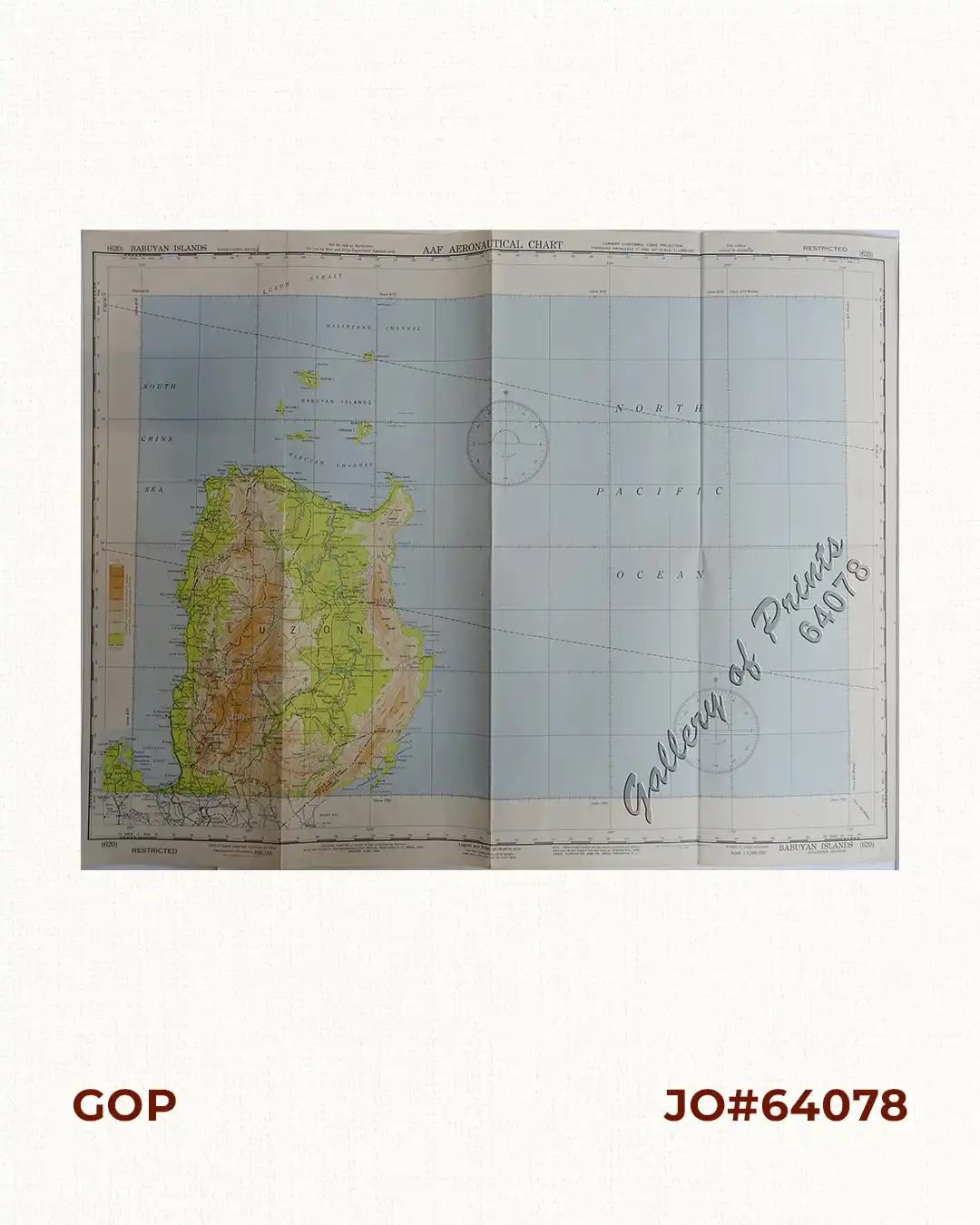
Description
original colour lithograph. EXTREMELY RARE. This WWII map depicts the northern portion of the Island of Luzon and the Babuyan channel. On verso, it shows the World Pilotage Chart Index, Aeronautical Symbols, Topographical Features, Hydrographic Features, Cultural and Miscellaneous Features etc.
![Les Isles Philippines, celle de Formose, le Sud de la Chine, les Royaumes de Tunkin, de Cochinchine, de Camboge, de Siam, des Laos… inset: 1) Isle de Guam. 2) [Isles Marianes]](https://galleryofprints.shop/wp-content/uploads/2015/06/JO61653-Bonne-1778-Les-Isles-Philippines-scaled-1-600x750.webp)
![Typus freti Manilensis detroit de Manilles [Straits of Manila]](https://galleryofprints.shop/wp-content/uploads/2015/05/JO54051-Renneville-1725-Philippines-Manila-Samar-Mindoro-Luzon-scaled-1-600x750.webp)
![Cygne Sauvage [Wild Swan]](https://galleryofprints.shop/wp-content/uploads/2024/08/jo64203-Verneuil-1897-Cygne-Sauvage-scaled-1-600x750.webp)