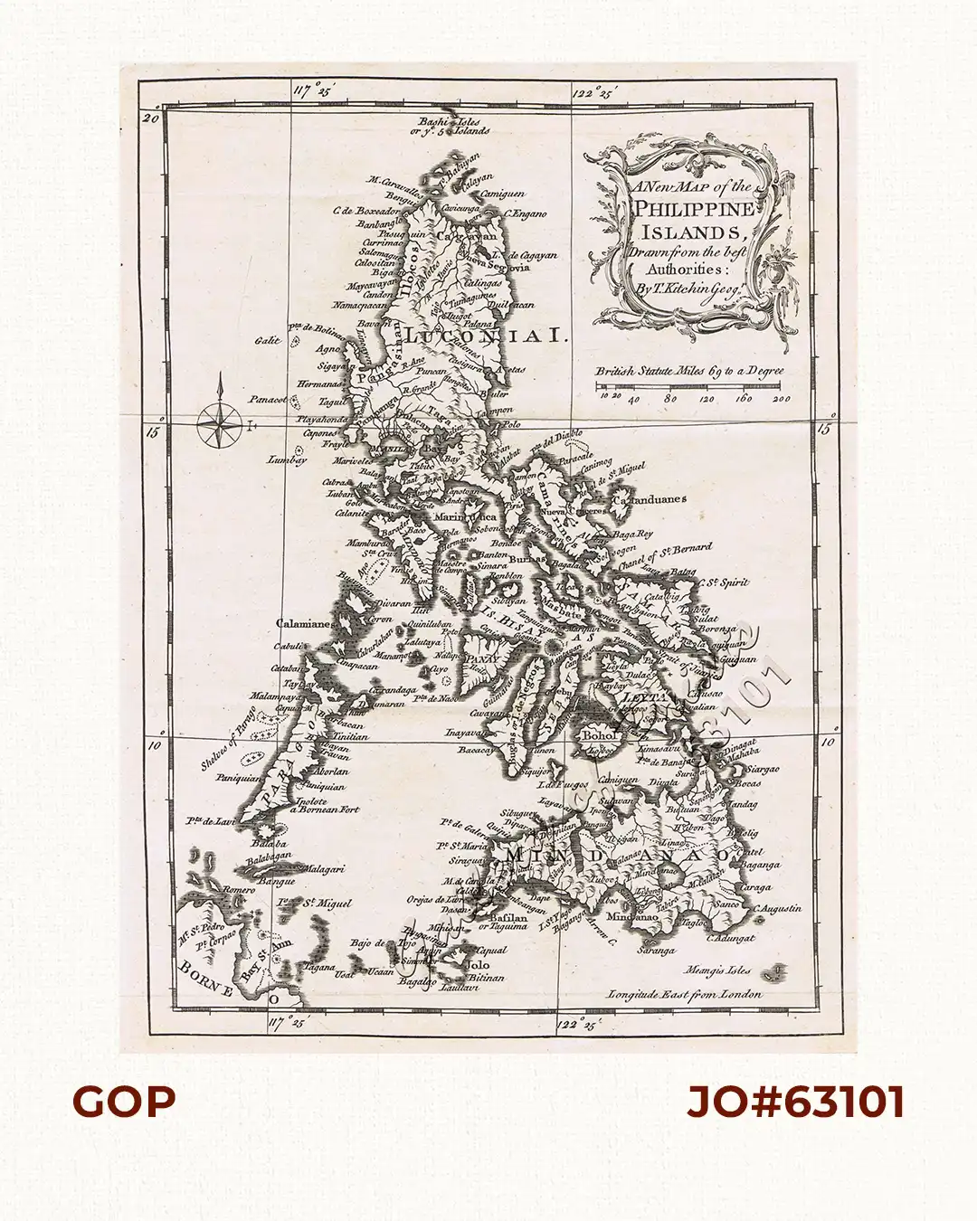
Description
copper engraving, decorative cartouche, compass rose.
EXTREMELY RARE map from “Continuation of the Complete History of England”.
The book contains a contemporary description of the Philippines and the British Conquest of Manila with this supporting map engraved precisely during those occupational years.
The map identifies Scarborough Shoal as “Panacot” and was used as part of the collection of antique maps submitted by the Philippines to UNCLOS (The United Nations Convention on the Law of the Sea.)
Printed for James Rivington and James Fletcher Oxford-Theatre and R. Baldwin at the Rose, in Paternoster Row.
![Plan des principaux ports de la côte d'Illocos … [Map of the Principal Ports of the Ilocos Coast]](https://galleryofprints.shop/wp-content/uploads/2024/07/JO62314c-Mannevillette-1775-Plan-des-principaux-ports-scaled-1-600x750.webp)