![Philippine Islands West Cost of Luzon Capones Islands to Dasol Bay [insets:] 1) Philippine Islands Iba Anchorage 2) Philippine Islands Santa Cruz Inner Harbor](https://galleryofprints.shop/wp-content/uploads/2026/05/jo61110-Philippine-Islands-Capones-Islands-to-Dasol-Bay-1952-scaled-2.webp)
![Philippine Islands West Cost of Luzon Capones Islands to Dasol Bay [insets:] 1) Philippine Islands Iba Anchorage 2) Philippine Islands Santa Cruz Inner Harbor - Image 2](https://galleryofprints.shop/wp-content/uploads/2026/05/jo61110-Philippine-Island-Capones-Islands-to-Dasol-Bay-1952-cartouche-700x834-1.webp)
![Philippine Islands West Cost of Luzon Capones Islands to Dasol Bay [insets:] 1) Philippine Islands Iba Anchorage 2) Philippine Islands Santa Cruz Inner Harbor - Image 3](https://galleryofprints.shop/wp-content/uploads/2026/05/jo61110-Philippine-Island-Capones-Islands-to-Dasol-Bay-1952-hand-written-on-verso-scaled-1.webp)
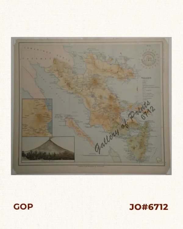
Description
RARE collectible 6th edition 1941 World War II lithograph map #4210, seachart published at Washington, D. C.
6th edition May 1941 – 1st edition 1907 by U.S Coast and Geodetic Survey, R. F. A. Studds, Director.
Corrected through Notice to Mariners No. 4, Jan 26 1952, U.S. Navy Hydrographic Office.
with “41-5/9; 42- 6/26; 48- 3/1, 4/26; 51- 1/1”