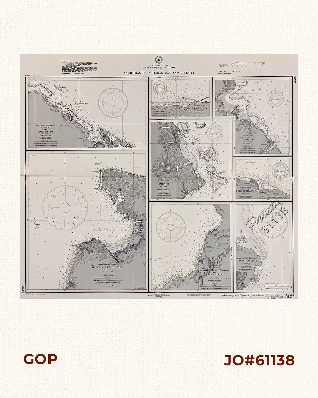
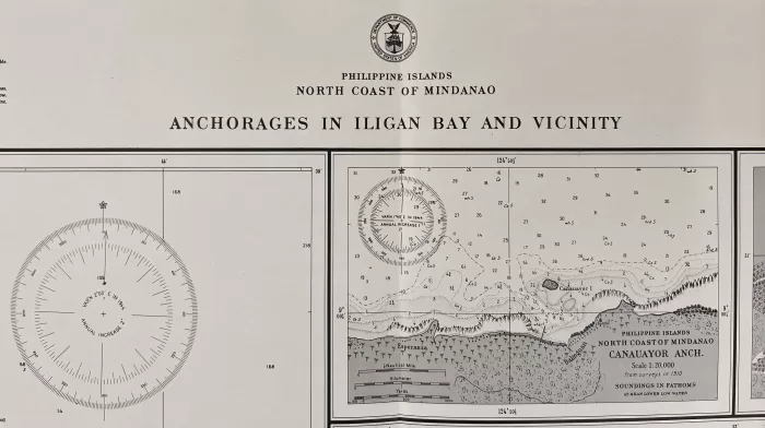
Phone: +63 2 7729 8168 | Mobile: +63 917 806 4291

Philippine Islands North Coast of Mindanao Anchorages in Iligan Bay and Vicinity insets: 1) Plaridel and Inamucan Bay. 2) Canauayor Anch. 3) Oroquieta. 4) Dapitan amd Dipolog. 5) Jimenez. 6) Camiguin Island. Port Mambajao. 7) Iligan and Overton Anchorages and Quinalang Cove. 8) Cagayan Anch.

11,000.00

Author: U. S. Coast and Geodetic Survey [U.S.C. & G.S.]

Publisher: U.S. Coast and Geodetic Survey, Washington, D.C.

Year: 1944 [1941] [1937]

Size: 72.6 x 90 cm; insets: 1) 35.1 x 41.5 cm, 2) 14.5 x 21.6 cm, 3) 27.3 x 27.1 cm, 4) 47.6 x 41.6 cm, 5) 28.1 x 28.6 cm, 6) 15.5 x 20 cm, 7) 30.1 x 28.6 cm, 8) 30.1 x 20 cm

1 in stock

Description

RARE collectible 1944 World War II lithograph map #4639, seachart published at Manila, P.I. Oct. 1937
by the U.S. Coast and Geodetic Survey, Reissued June 1941, L.O. Colbert, Director.
with stamp dated Sep 27 1944.
with stamp “restricted”
with “37-10/2, 41-6/2, Special Printing at Wash. D. C. (reprint 42- 5/7); 43-11/8”

Condition

with folds as issued, with hand-written title “Philapines Mindanao North Coast” on verso, very good condition.

Shopping cart0
There are no products in the cart!
Continue shopping
0