![Philippine Islands Luzon and Samar San Bernardino Strait [insets:] 1) Philippine Islands Northwest Coast of Samar Mauo River 2) Philippine Islands North Coast of Samar Biri Anchorage](https://galleryofprints.shop/wp-content/uploads/2026/05/jo61115-Philippine-Islands-San-Bernardino-Strait-1952-scaled-1.webp)
![Philippine Islands Luzon and Samar San Bernardino Strait [insets:] 1) Philippine Islands Northwest Coast of Samar Mauo River 2) Philippine Islands North Coast of Samar Biri Anchorage - Image 2](https://galleryofprints.shop/wp-content/uploads/2026/05/jo61115-Philippine-Islands-San-Bernardino-Strait-1952-cartouche-700x869-1.webp)
![Philippine Islands Luzon and Samar San Bernardino Strait [insets:] 1) Philippine Islands Northwest Coast of Samar Mauo River 2) Philippine Islands North Coast of Samar Biri Anchorage - Image 3](https://galleryofprints.shop/wp-content/uploads/2026/05/jo61115-Philippine-Islands-San-Bernardino-Strait-1952-hand-written-on-verso-scaled-1.webp)
Description
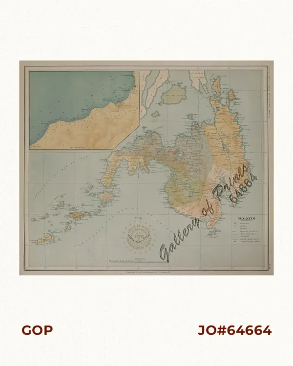
RARE lithograph map #4220, seachart published at Washington, D. C.
4th Edition Aug. 1936 – 1st edition 1907 by U.S Coast and Geodetic Survey, R. F. A. Studds, Director.
with stamp dated Oct 23 1950.
Corrected through Notice to Mariners No. 4, Jan 26 1952, U.S. Navy Hydrographic Office.
with “36-8/3; 38- 11/2; 42- 1/12; 43-11/16; 45-6/30; 48- 4/19; 50-8/14”
![Islas de Infanta y Polillo pl. 12 [Quezon Prov., Polilio Is., Pananongan I., Jomalig I.]](https://galleryofprints.shop/wp-content/uploads/2023/08/JO62585-Algue-1900-Quezon-Province-Polilo-Jomalig-Patnanongan-scaled-1-600x750.webp)