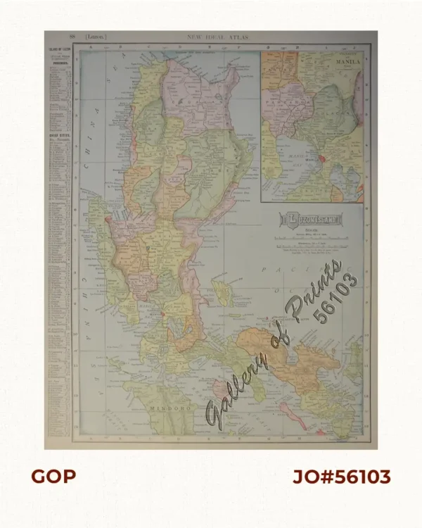
![Philippine Islands [insets:] [1] Trade Routes of the Orient. [2] Central Luzon](https://galleryofprints.shop/wp-content/uploads/2026/05/jo65280-Bach-John-Philippine-Islands-1929-scaled-1.webp)
Description
original coloured lithograph. EXTREMELY RARE.
Beautifully executed large vintage map by John Bach and lithographed in Manila by Carmelo and Bauermann, 6th edition. It captures the Philippines at a turning point, just as the Great Depression began and momentum toward independence was building. It details islands across the archipelago, with provincial boundaries on Luzon, Panay, and Mindanao, and shows settlements, roads, railways, and key natural resources like gold, copper, and coal. Sea routes connect the islands and extend to regional hubs such as Singapore, Hong Kong, and Japan. Insets highlight Central Luzon’s transport network and broader trade routes across the Pacific and Indian Oceans, while a distance table lists key maritime links.
At the time, the Philippines was an American colony of about 13 million people, experiencing relative stability and economic growth despite ongoing nationalist tensions. The global economic crisis exposed colonial limitations and intensified calls for self-rule, led by figures like Manuel Quezon, culminating in the establishment of the Commonwealth in 1935.