Description
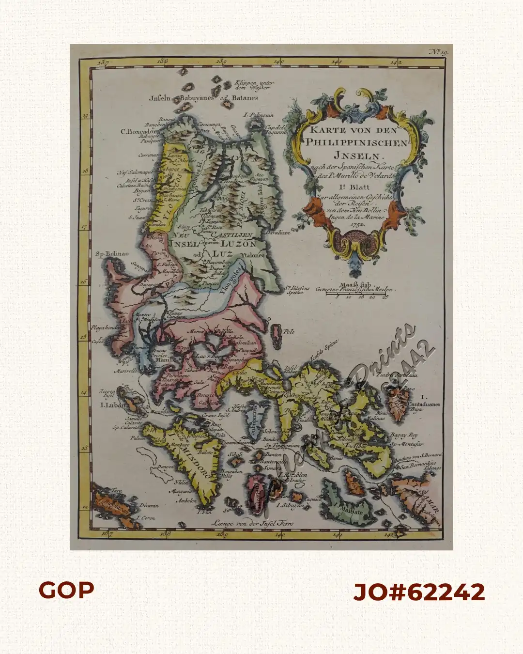
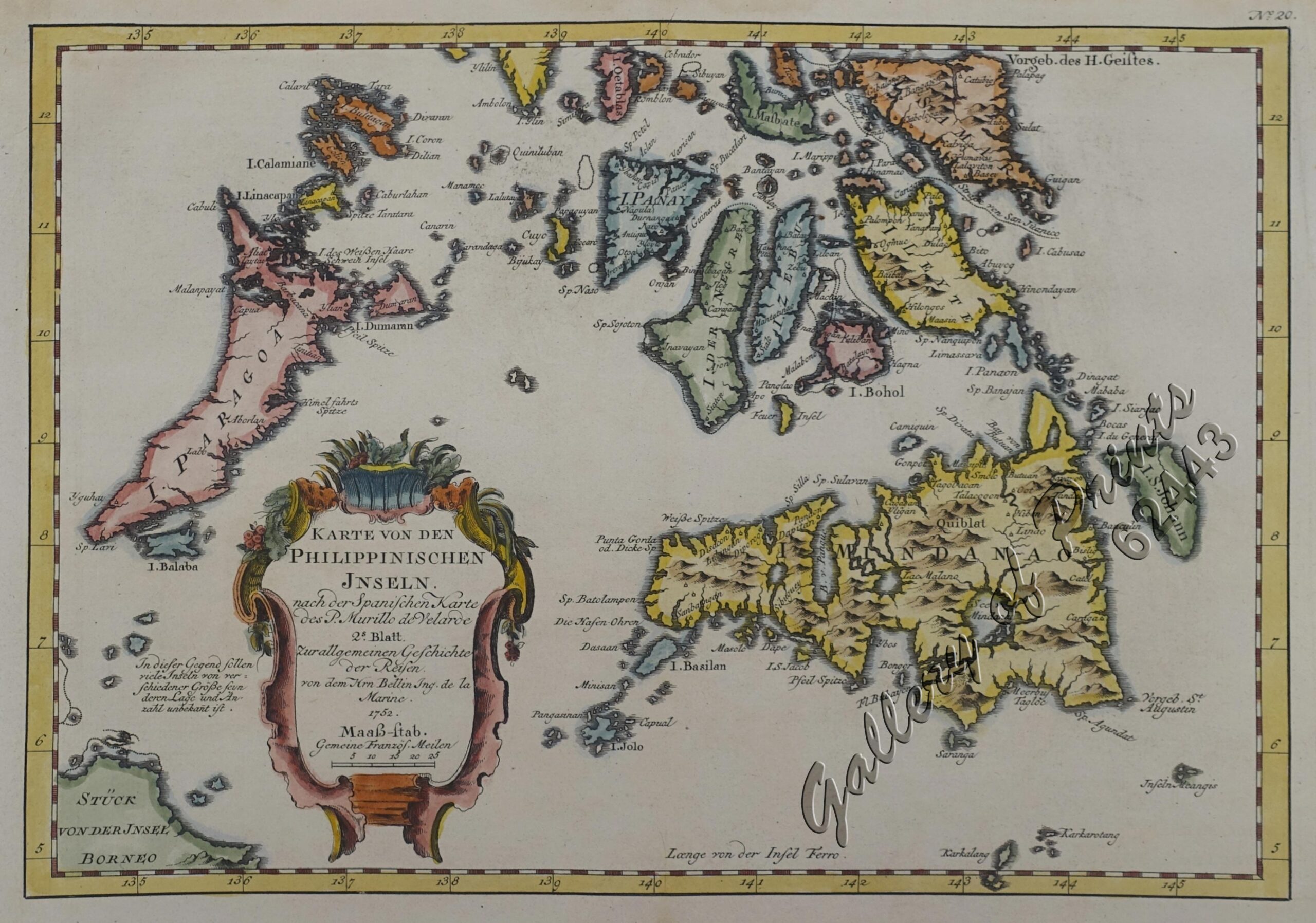
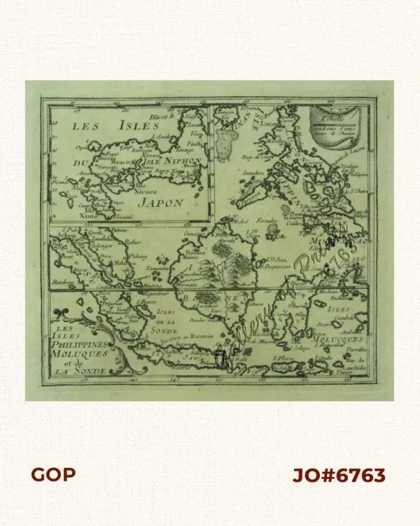
hand-coloured copper engraved RARE pair of the German edition of Bellin’s French maps of Northern and Southern Philippines.
Maps from ‘Allgemeine Historie der Reisen zu Wasser und Land… oder Sammlung aller Reisebeschreibungen…’ (11. Band); plate Nr. 19 and 20 – translation from the French. This is the rare German version of the original French publication by Jacques Bellin, here as a complete pair of Northern and Southern Philippines after Pedro Murillo de Velarde. Nicolas Bellin (1703-1772) was one of the most important and proficient French cartographers of the mid-eighteenth century. He was appointed the first Ingenieur Hydrographe de la Marine, and also Official Hydrographer to the French king. Bellin produced a substantial number of important separately issued maps, particularly reflecting continuing discoveries and political events in the Americas.
![Sammlung gemeinverständlicher wissenschaftlicher Vorträge [Collection of Scientific Presentations in a Generally Comprehensible Version] [INCLUDING:] Die Philippinen. Eine übersichtliche Darstellung der ethnographischen und historisch=politischen Verhältnisse des Archipels. [An Overview of the Ethnographic and Historical-Political Situation in the Archipelago] Mit einem Anhange - Die wichtigsten Paragraphen der Verfassung der philippinischen Republik. [The most important paragraphs of the Constitution of the Philippine Republic]](https://galleryofprints.shop/wp-content/uploads/2018/06/JO12236-Virchow-1886-1900-Sammlung-gemeinverstandlicher-wissenschaftlicher-Vortrage-scaled-1-600x750.webp)