Description
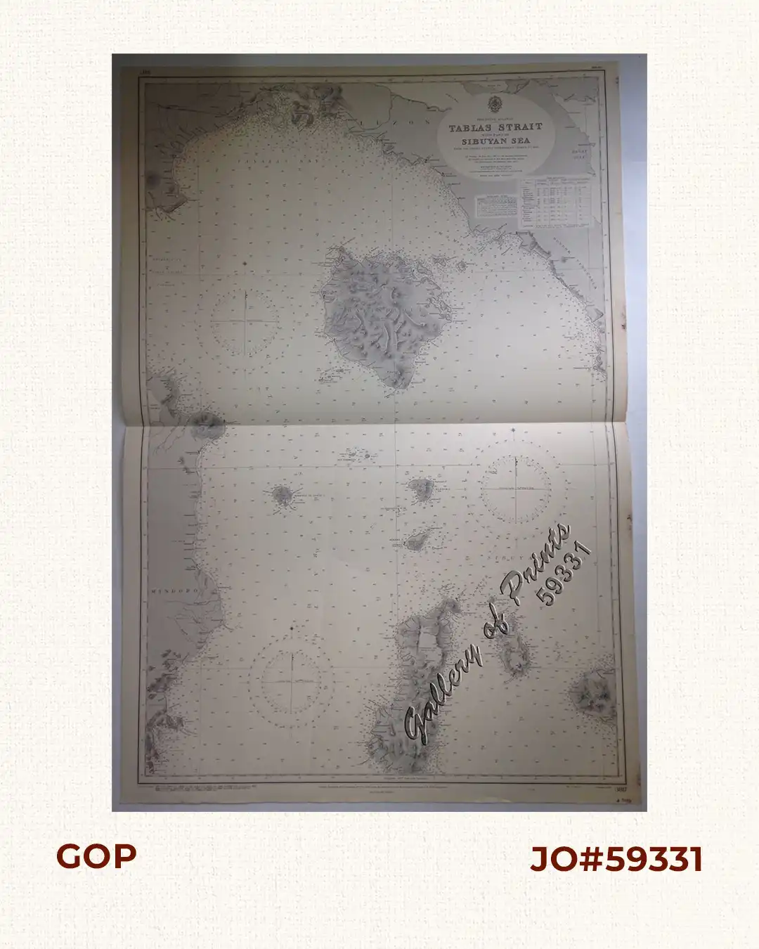
lithograph. Map#3817. Small corrections 1937[many subsequent years stated till] 1966 – Z.4-65. Seal of the Hydrographic Office – 3 Sea Roses with 360 degrees.
₱11,000.00
Author: not indicated
Publisher: Admiralty London, 6th Nov. 1936 under the Superintendence of Rear-Admiral J.A.Edgell, C.B., O.B.E., Hydrographer.
Year: 1966 [1937]
Size: 98.9 x 66.2 cm
1 in stock
lithograph. Map#3817. Small corrections 1937[many subsequent years stated till] 1966 – Z.4-65. Seal of the Hydrographic Office – 3 Sea Roses with 360 degrees.
with center fold as issued.
![Carte du Theatre de la Guerre Hispano - Americaine [Map of the Spanish-American War Theatre] (inset Philippines)](https://galleryofprints.shop/wp-content/uploads/2016/01/JO1839-Anonymous-c.1899-Carte-du-Theatre-de-la-Guerre-Hispano-Americaine-scaled-1-600x750.webp)