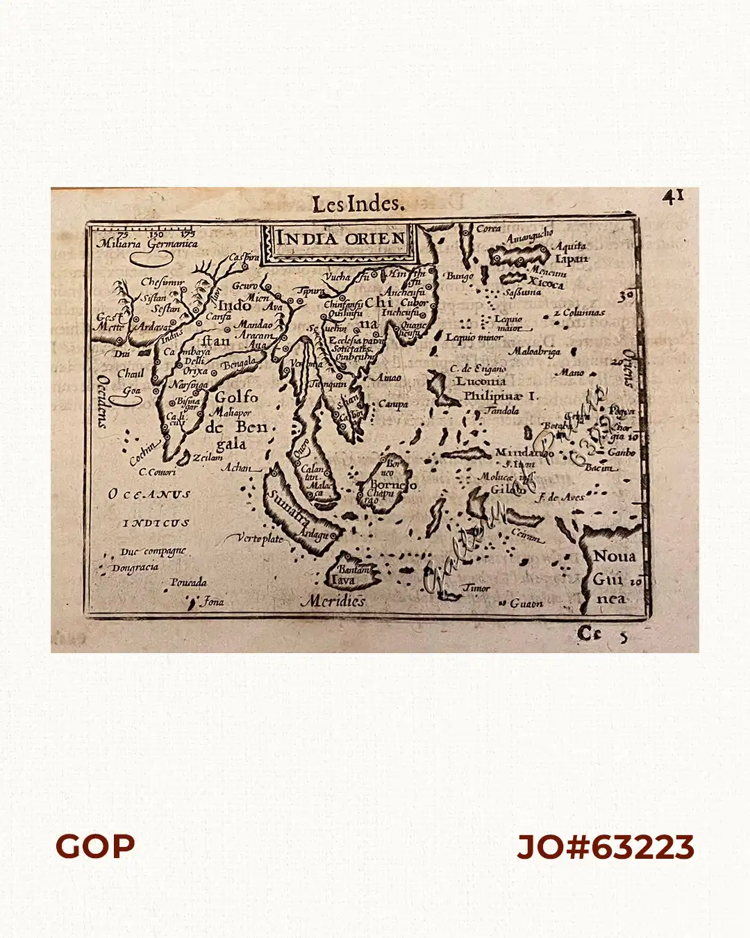
Description
copper engraving, French text verso: ‘Description des Indes’. RARE.
Barent Langenes’ map of Southeast Asia from the French edition of his Caert-Thresoor: Thresor de Chartes, contenant les Tableaux de tous les Pays du Monde”, pp. 41-42; published and translated through A. Henry de la Haye who was a rector and clergyman in Kampen. The map depicts the East Indies with the Philippines, Korea, Japan, China, Sri Lanka, Tibet, Bhutan, India and part of Papua-New Guinea.
Barent Langenes was a bookseller and publisher in Middelburg who published some travel descriptions and this Caert-Thresoor; little else is known.
Kaerius or Pieter van den Keere (1571-1646) was one of many Flemish refugees who fled from religious persecution in the Low Countries (Netherlands, Belgium, etc.) between 1570-1590. He moved to London with his sister, who married Jodocus Hondius, the famous cartographer, from whom Kaerius must have learned his skills as an engraver & cartographer. Koeman distinguishes two atlases: The “original” ‘Caert-Thresoor’, published by Langenes and Claesz with 5 editions from 1598-1609; and the ‘Tabularum Geographicarum Contractarum’ by Petrus Bertius with 10 editions from 1600-1650.
Petrus Bertius (1565-1629) was another Flemish refugee; he settled in Amsterdam and became a professor of mathematics and librarian at the University of Leiden. In 1618 he moved to Paris as cosmographer and historiographer of Louis XIII till his death.