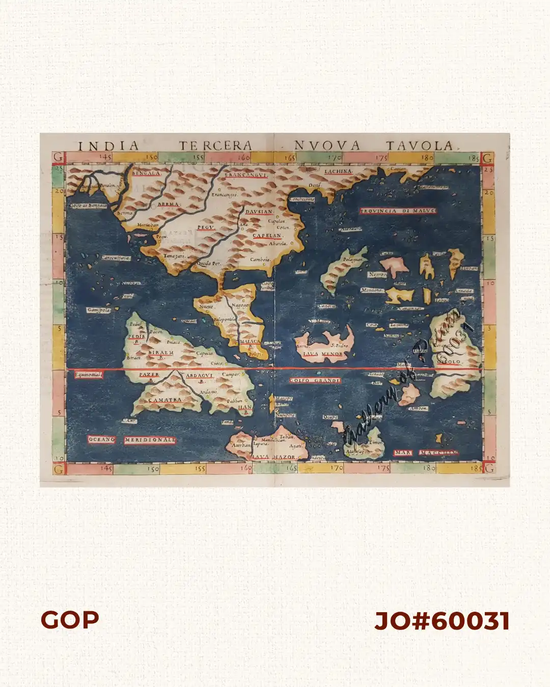
Description
hand-coloured copper engraving.
Map after Gastaldi from “La Geographia: Descrittione dell’ Asia”, 3rd vol., p. 122; published by M. Sessa in Venezia, Italy, showing several detailed Philippine Islands without Luzon, as unknown at that time: Candingan = Sarangani; Caylo = Panaon; Cubu = Cebu; Hohol = Bohol (?); Huban = Leyte(?) Mendana = Mindanao; Negros; Polaguan = Palawan. Sumatra is ‘Camatra’; Java is ‘Java Mazor’; Borneo is ‘Java Menor’.
This is Ruscelli’s early edition Italian translation from the Greek of Ptolemy’s Geographia. Revised, expanded and edited by Giuseppe Rosaccio, included newly engraved copperplates by Giulio and Livio Sanuti, issued in Venice several times between 1561 and ca. 1600.
Claudius Ptolemaeus (90-168 CE), a Roman geographer and mathematician living in Egypt, who compiled his knowledge and theories about the world’s geography into one seminal work.