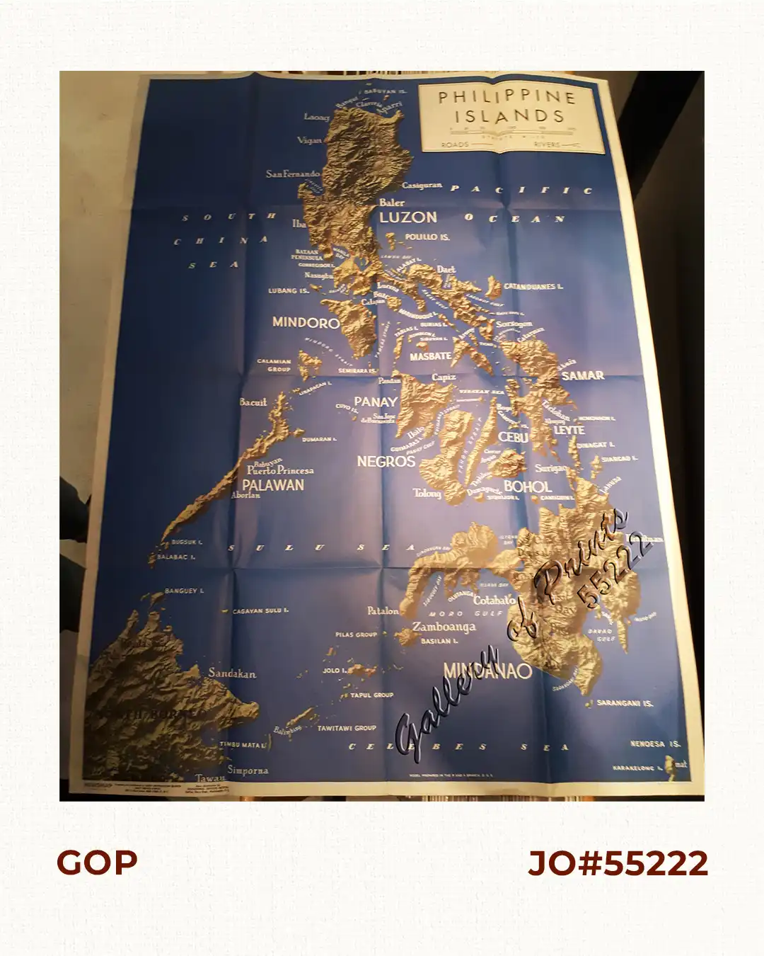
Description
original colour lithograph, with roads and rivers marked. verso: Southern France and Pacific Arena with text articles. RARE WW II map.
Map from “Newsmap for the Armed Forces, 258th Week of the War – 140th Week of U.S. articipation, Monday, 21 August, 1944.
![Typus freti Manilensis detroit de Manilles [Straits of Manila]](https://galleryofprints.shop/wp-content/uploads/2015/05/JO54051-Renneville-1725-Philippines-Manila-Samar-Mindoro-Luzon-scaled-1-600x750.webp)
![Carte du Theatre de la Guerre Hispano - Americaine [Map of the Spanish-American War Theatre] (inset Philippines)](https://galleryofprints.shop/wp-content/uploads/2016/01/JO1839-Anonymous-c.1899-Carte-du-Theatre-de-la-Guerre-Hispano-Americaine-scaled-1-600x750.webp)