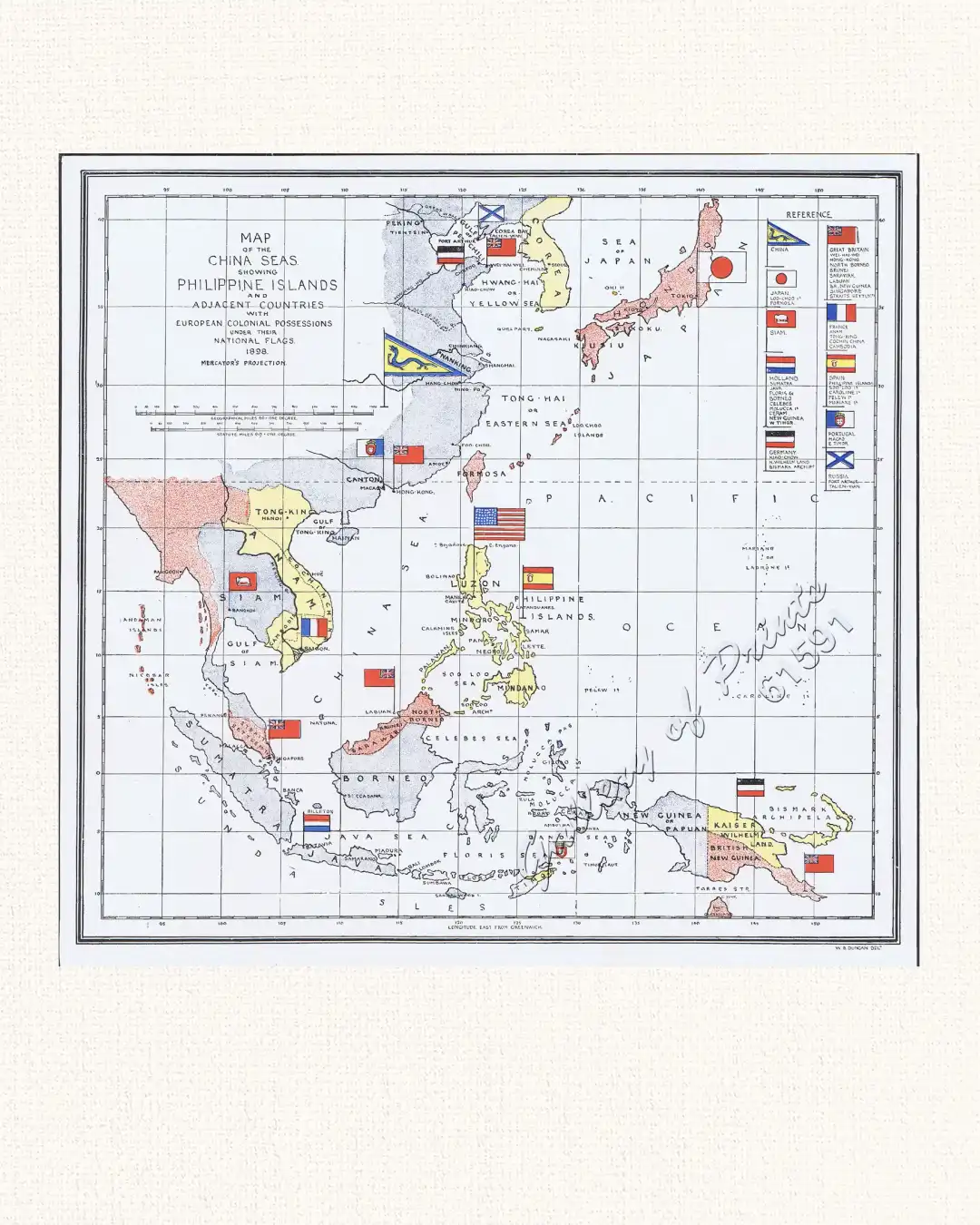
Map of the China Seas showing Philippine Islands and Adjacent Countries with European Colonial Possessions under their National Flags. 1898 Mercator’s Projection
We use cookies and similar technologies to improve your browsing experience, analyze site traffic, and support our services.You may accept all cookies or manage your preferences at any time. For more details, please read our Privacy Notice.
Cookie Preferences
Manage your cookie preferences below:
Essential cookies enable basic functions and are necessary for the proper function of the website.
Name
Description
Duration
Cookie Preferences
This cookie is used to store the user's cookie consent preferences.