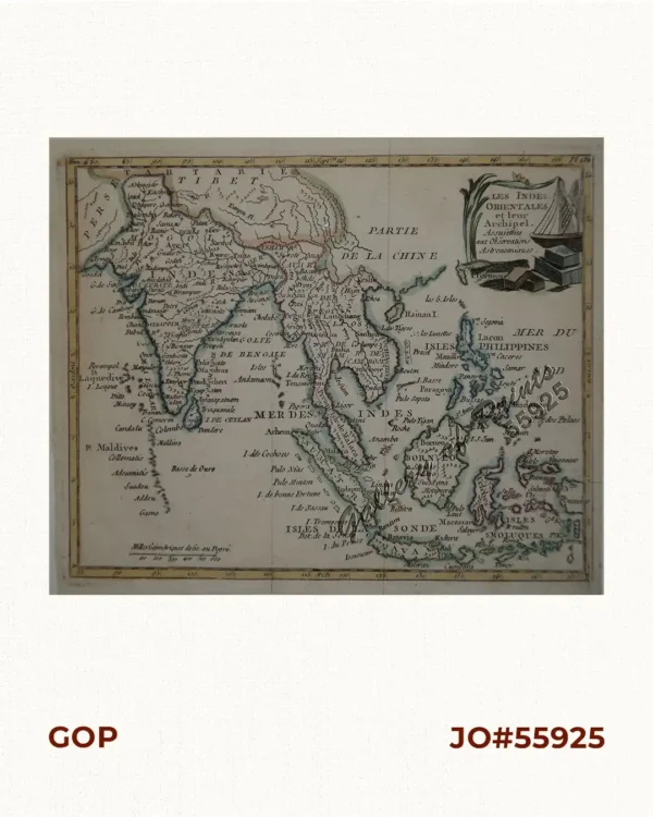
![A Map of the East Indies from the latest Authorities and Observations By John Blair L.L.D. & F.R.S. As a Supplement to His Tables of Chronology. [inset:] The Philippine Islands.](https://galleryofprints.shop/wp-content/uploads/2016/03/JO60783-Blair-c1770-A-Map-of-the-East-indies-from-the-latest-Authorities-and-Observations-scaled-1.webp)
Description
copper engraving.
RARE large format map of Southeast Asia, India, and part of China, extending to Tibet, the Maldives, Sumatra, part of Borneo, Hainan, Kanton, etc. Colored by Kingdoms, Provinces, etc. Large inset of the Philippines. Highly detailed. From John Blair’s “Chronology and History of the World”, first published in 1754.