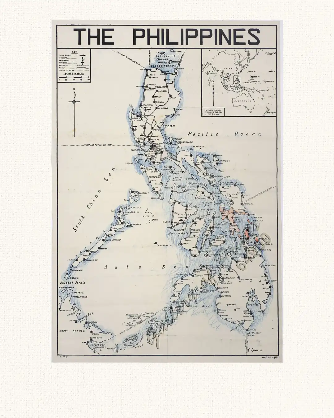
Description
photolithograph with contemporary outline colour in blue and orange crayon, docketed with manuscript title on verso. Small inset map of Asia Pacific and Australia. “C.P.O.” in lower left – “MAP N1 244” in lower right. VIRTUALLY IMPOSSIBLE TO FIND SINGLE SPECIMEN
An EXTREMELY RARE – no other examples traced – map of the Philippines issued in the Autumn of 1944, as the United States was commencing its efforts to liberate the Japanese-occupied archipelago; published in Shimla (then ‘Simla’), India by the British Raj’s Department of Information as a loose-leaf accompaniment to their newspaper Weekly News Report.
The map embraces the entirety of the Philippines, labelling all islands and cities. The legend, in the upper left corner, identifies the symbols that indicate militarily important details, such as naval bases, harbours, anchorages, airfields, railways and roads, while the dotted lines labelled by destinations and distances in miles are key air routes. Interestingly, the present example features manuscript shading in orange crayon indicating the areas conquered by American-Filipino forces during the Leyte and Samar Campaigns (October 17, 1944 – January 1945), whereby the Allies gained their first real beachhead in the Philippines, thus bearing evidence of having been used to follow the initial stages of the U.S. invasion of the Philippines.