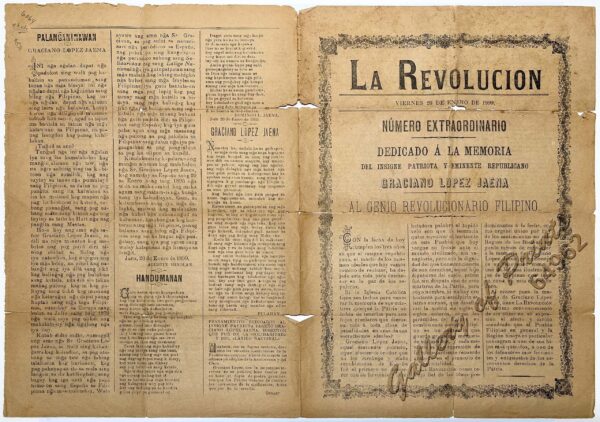
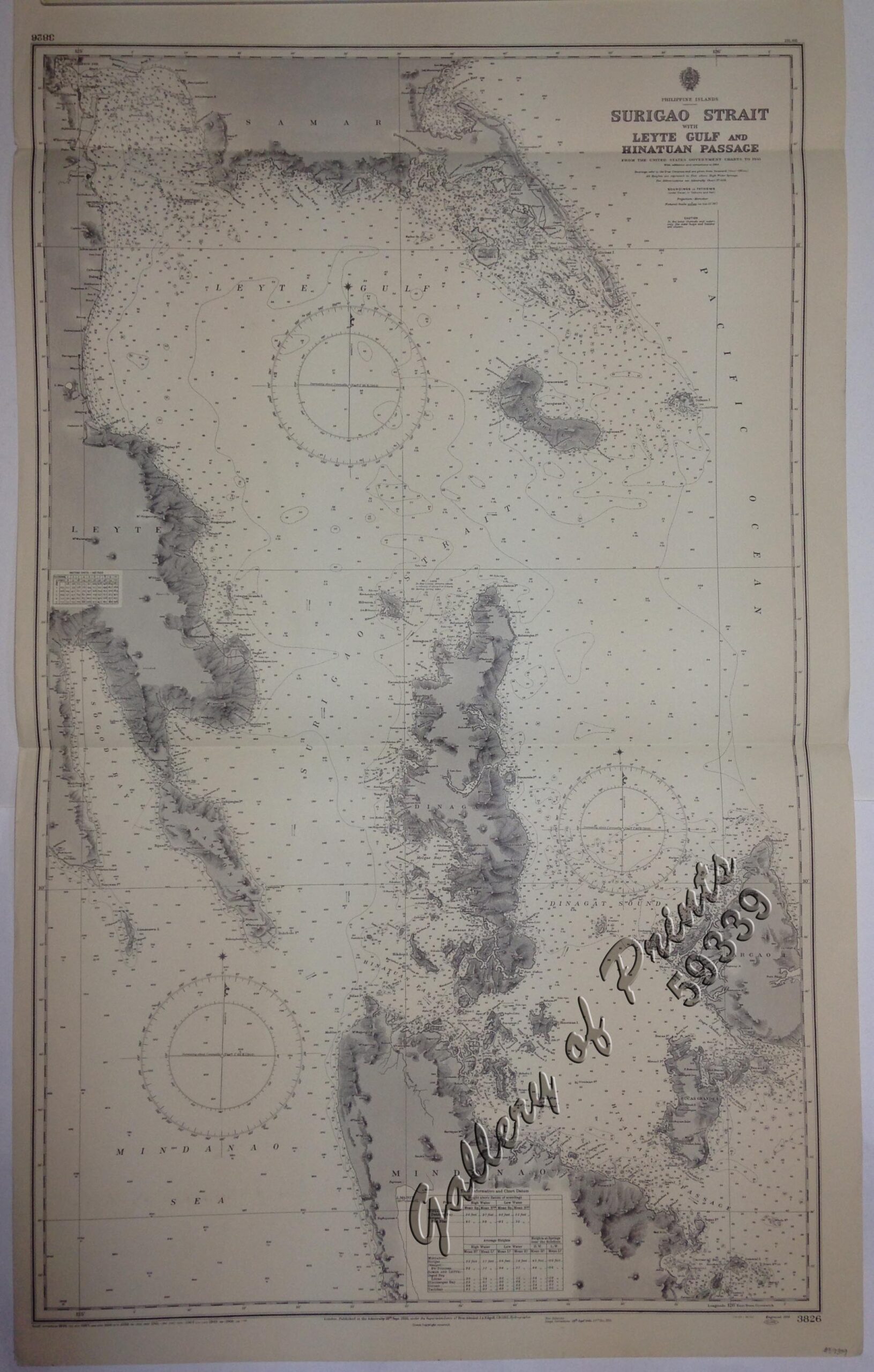
Description
lithograph. Map#3826. Large Corrections 28th Sept. 1945…23rd Dec. 1955. Small corrections 1956 [many subsequent years stated till] 1966 – Z/c 1958. Seal of the Hydrographic Office – 3 Sea Roses with 360 degrees. RARE.
₱11,000.00
1 in stock
lithograph. Map#3826. Large Corrections 28th Sept. 1945…23rd Dec. 1955. Small corrections 1956 [many subsequent years stated till] 1966 – Z/c 1958. Seal of the Hydrographic Office – 3 Sea Roses with 360 degrees. RARE.
with folds as issued.


![Rajah Malais et sa Femme (voy. p. 102) [Malay Rajah and Spouse]](https://galleryofprints.shop/wp-content/uploads/2015/05/JO54249-Charton-1884-Philippines-Mindanao-600x750.webp)