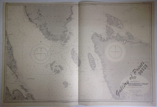
Description
lithograph. Map#3370. New Editions 17th May 1935. Small corrections 1935 [many subsequent years stated till] 1966 – Z. 12-62. Seal of the Hydrographic Office – 2 Sea Roses with 360 degrees. RARE.

₱11,000.00
1 in stock
lithograph. Map#3370. New Editions 17th May 1935. Small corrections 1935 [many subsequent years stated till] 1966 – Z. 12-62. Seal of the Hydrographic Office – 2 Sea Roses with 360 degrees. RARE.
with center fold as issued.