Description
original-colour lithograph. RARE.
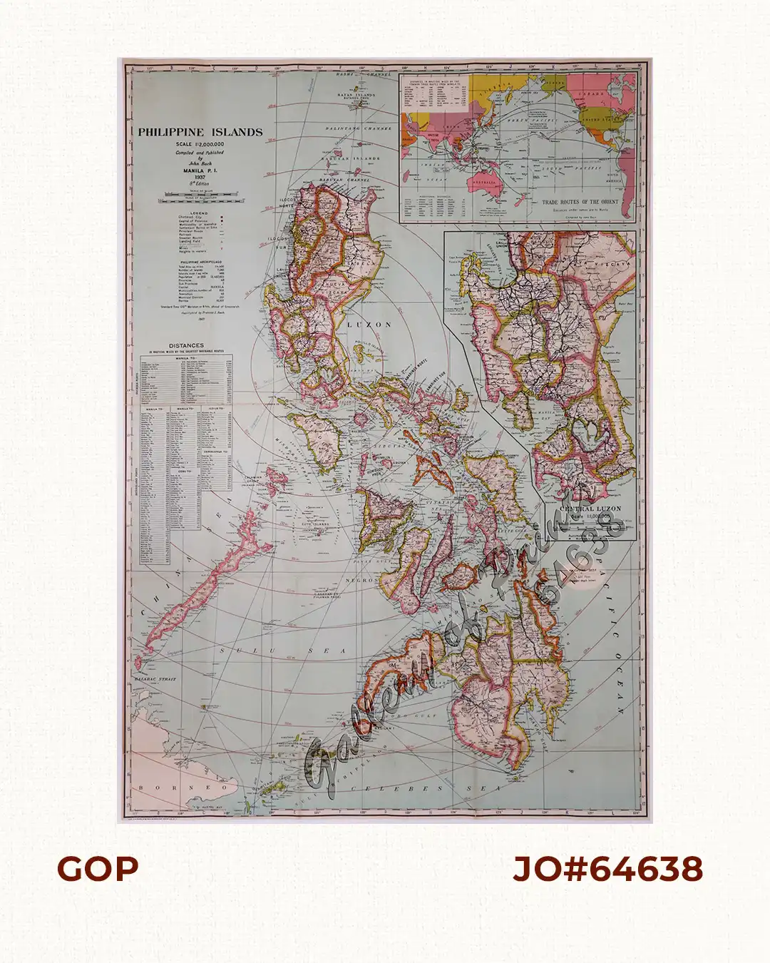
Beautifully executed large folding vintage pocket map of the Philippine Islands, with large insets of Trade Routes of the Orient, and Central Luzon. This is the eighth edition of John Bach’s map of the Philippines, providing great detail about this American colony and issued shortly before the beginning of World War II.
It was issued during the 10-year Great Depression in the US and right after the establishment of the Commonwealth of the Philippines in 1935. J. Bach became the Head of the Drafting Division in the Bureau of Coast and Geodetic Survey Philippines in 1917.
![Typus freti Manilensis detroit de Manilles [Straits of Manila]](https://galleryofprints.shop/wp-content/uploads/2015/05/JO54051-Renneville-1725-Philippines-Manila-Samar-Mindoro-Luzon-scaled-1-600x750.webp)
![Isla de Luzon pl. 10, inset: Pto. de Banacalan [Marinduque] (Quezon [or Tayabas], Camarines Norte, Marinduque, Balegin [Balesin], Calbalete [Cagbalete]… )](https://galleryofprints.shop/wp-content/uploads/2023/08/JO64134-Algue-1900-Isla-de-Luzon-scaled-1-600x750.webp)