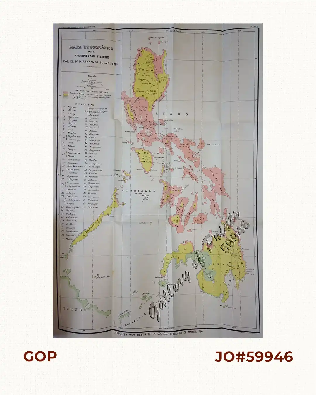
Description
original-colour photolithograph, virtually pristine condition. One of several existing different Philippine maps by Ferdinand Blumentritt. Ethnographic map, pl. 1; from ‘List of the Native Tribes of the Philippines and of the Languages Spoken by Them’; reproduced from the ‘Boletin de la Sociedad Geografica de Madrid, 1890. Extracted from the Annual Report to the Board of Regents of the Smithsonian Institute, Washington, published in 1901 during the Philippine-American War (1899-1902). Colour-coding differentiates Christian Filipinos from “New Christians” and “Non-Believers”, identifies Muslim regions and cites 63 different local tribes.
![Les Isles Philippines, celle de Formose, le Sud de la Chine, les Royaumes de Tunkin, de Cochinchine, de Camboge, de Siam, des Laos… inset: 1) Isle de Guam. 2) [Isles Marianes]](https://galleryofprints.shop/wp-content/uploads/2015/06/JO61653-Bonne-1778-Les-Isles-Philippines-scaled-1-600x750.webp)