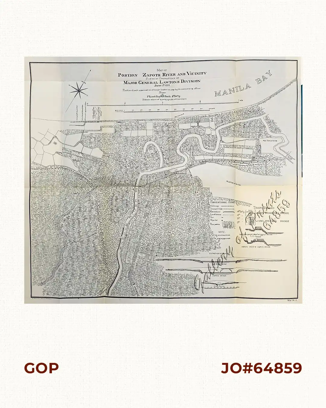
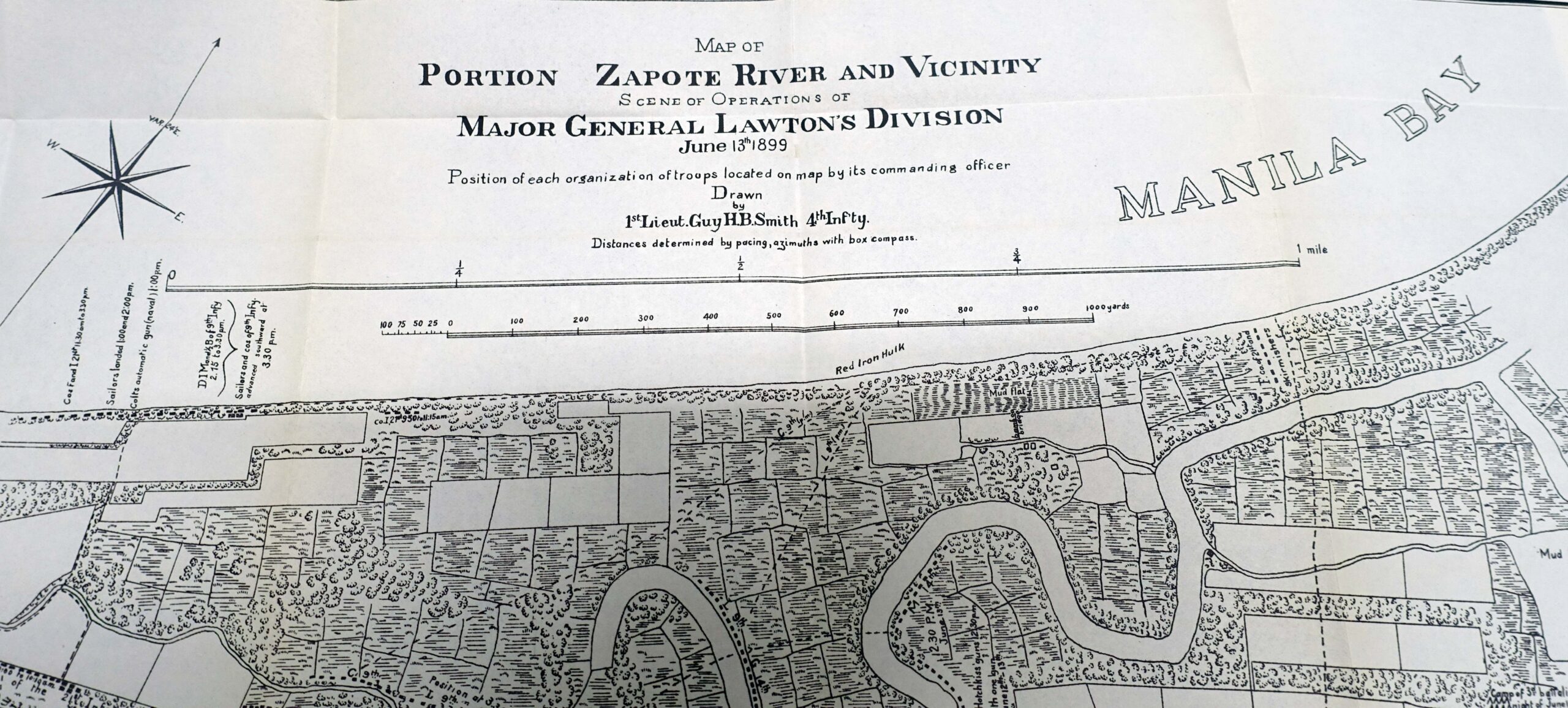
Description
photo lithograph map. SCARCE. Depicts and describes the various positions of the American Forces in the clearly delineated and clearly marked topography of ricefields, bushes, trees, trenches and elevations. Also identifies “retreating insurgents”, i.e. Filipino soldiers.

![La Guerra Hispano-Americana. Puerto-Rico y Filipinas [The Spanish-American War. Puerto-Rico and the Philippines]](https://galleryofprints.shop/wp-content/uploads/2024/06/JO12666-Gomez-Nunez-1902-La-Guerra-Hispano-Americana-Puerto-Rico-y-Filipinas-front-600x750.webp)