Description
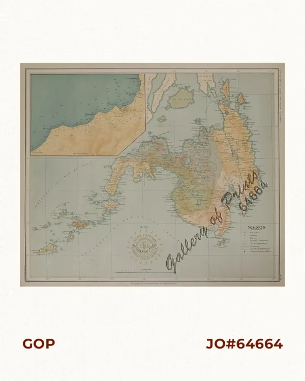
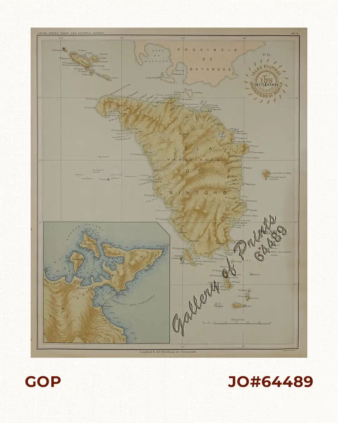
original colour lithograph.
Map from ‘Atlas de Filipinas’, made in 1899 but published in 1900 by the US Coast and Geodetic Survey (Gov’t Printing Office) in Washington, D.C. Considered ‘as the most complete and accurate survey of the archipelago made up to that time. 24 pages and 30 coloured plates. Father Algue was the director of the Manila Observatory at the time. The technical work on the atlas was executed wholly by Filipino draftsmen. (acknowledged in the introduction).