Description
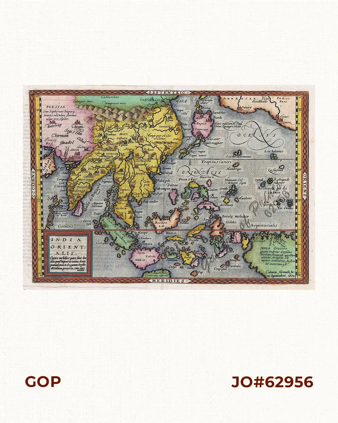
hand-coloured copper engraving. EXTREMELY RARE map from “Geographisch Handtbuch”,
published by Johann Bussemacher in Cologne/Germany. A very attractive early map of South
East Asia, stretching from Persia in the north west to New Guinea in the South-east The coastlines
are recognizable but approximate. Part of the west coast of North America is shown at top right,
showing lack of knowledge of the size of the Pacific at the time. The map includes the mythical
land of “Beach”, potentially Australia, from Marco Polo’s reports and extends to California, where
Quivira and two other cities are shown. Japan is in its “Kite” configuration. There are many similarities
“with the larger Ortelius map of the same title. The Philippines is shown still without Luzon.”
Bussemacher (1557-1613) was active as an engraver, printer and art dealer in Cologne, one of the
centres for German cartography, from about 1580 till his death.
Quad (1557–1613) was a cartographer and engraver also from Cologne, the first European
mapmaker to use dotted lines to indicate international borders.

![Isla de Luzon pl. 10, inset: Pto. de Banacalan [Marinduque] (Quezon [or Tayabas], Camarines Norte, Marinduque, Balegin [Balesin], Calbalete [Cagbalete]… )](https://galleryofprints.shop/wp-content/uploads/2023/08/JO64134-Algue-1900-Isla-de-Luzon-scaled-1-600x750.webp)