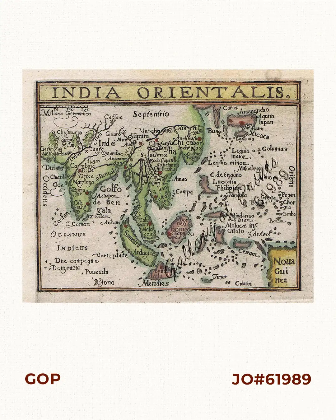
Description
hand-coloured copper engraving.
EXTREMELY RARE map from ‘Histoire Universelle des Indes Occidentales’, [after Kaerius 1597] 3rd French edition, the first edition was published by Francois Fabri in Douay in 1605, and a second edition appeared in 1607 – ANY Wytfliet map is very difficult to find and appears on the market only once every few years, specially of this part of the world.

![Isla de Luzon pl. 10, inset: Pto. de Banacalan [Marinduque] (Quezon [or Tayabas], Camarines Norte, Marinduque, Balegin [Balesin], Calbalete [Cagbalete]… )](https://galleryofprints.shop/wp-content/uploads/2023/08/JO64134-Algue-1900-Isla-de-Luzon-scaled-1-600x750.webp)