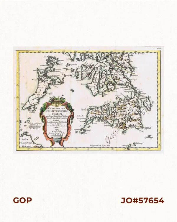
![Fortsetzung der Karte von dem Morgenlændischen Ocean die Eylande Sonda die Küsten von Tunquin und China die Eylande Japon die Philippinischen und Molukkischen Eylande in sich enthaltend….1746 [Continuation of the Map of the Orient Ocean with the Sunda Islands, Tonkin and China, the islands of Japan, the Philippines and Molukkas…]](https://galleryofprints.shop/wp-content/uploads/2018/10/JO61652-Bellin-1748-Fortsetzung-der-Karte-vom-dem-Morgenlandischen-scaled-1.webp)
Description
copper engraving.
RARE German edition of Histoire Generale des Voyages, volume 3. Zusatz zum 1. Bande 4e Karte [supplement to vol 1, map 4]. Nicolas Bellin (1703-1772) was one of the most important and proficient French cartographers of the mid-eighteenth century. He was appointed the first Ingenieur Hydrographe de la Marine, and also Official Hydrographer to the French king. Bellin produced a substantial number of important separately issued maps, particularly reflecting continuing discoveries and political events in the Americas.