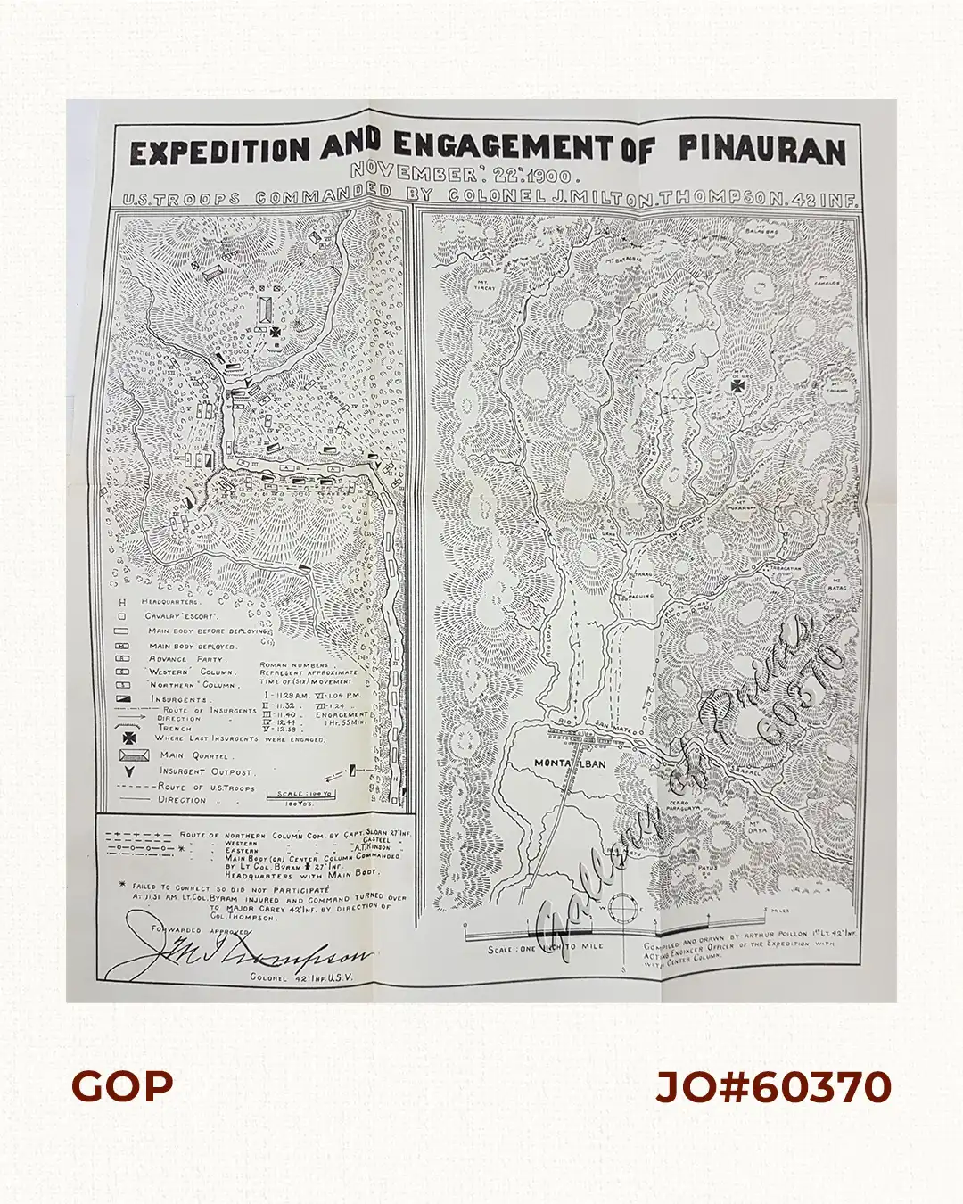
Description
lithograph map.
Signed in type by Colonel Thompson of the 42nd Infantry who took command after the original commander, Lt. Col. Byam of the 27th Infantry was injured.
The map shows detailed topography, routes of troops and Filipino forces, and the location of the final combat, 35 miles from Manila, when a thousand American forces captured a supposedly impregnable Filipino stronghold, the stone fortress of Pinauran atop a steep hill surrounded by canyons.

![Recollections of a Voyage to the Philippines [1875]](https://galleryofprints.shop/wp-content/uploads/2023/08/JO22165-de-Man-Aguilar-Cruz-1997-Philippines-front-600x750.webp)