Description
copper engraving.
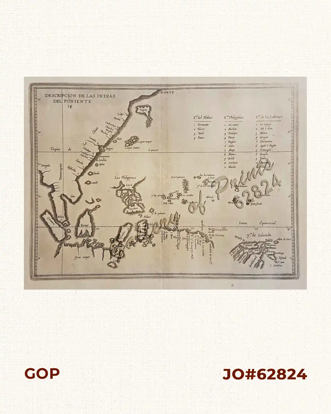
EXTREMELY RARE map from “Descripcion de las Islas occidentales, Historia General de los hechos de los castellanos en las Islas I Tierra firme del Mar Oceano., da. 314, 3rd edition.
The 1st edition was published in 1601 in Madrid; Herrera (1559-1625), a writer & official historian to the King of Spain, compiled a history of the Indies accompanied by maps of the West Indies & Central & South America. The book was re-issued in several editions & languages, the most important of which was the 2nd edition in 1622. This example is apparently from the 3rd edition. On this map, Luzon is not shown as an island, only as an outline; other Philippine islands are named, including his own “creation” (Copied after an earlier manuscript map by Juan Lopez de Velasco, ca. 1575-80): San Juan (St. John), the imaginary island to become so “notorious” in future maps till even the 19th century.
![Isla de Luzon pl. 10, inset: Pto. de Banacalan [Marinduque] (Quezon [or Tayabas], Camarines Norte, Marinduque, Balegin [Balesin], Calbalete [Cagbalete]… )](https://galleryofprints.shop/wp-content/uploads/2023/08/JO64134-Algue-1900-Isla-de-Luzon-scaled-1-600x750.webp)
![Islas de Infanta y Polillo pl. 12 [Quezon Prov., Polilio Is., Pananongan I., Jomalig I.]](https://galleryofprints.shop/wp-content/uploads/2023/08/JO62585-Algue-1900-Quezon-Province-Polilo-Jomalig-Patnanongan-scaled-1-600x750.webp)