Description
RARE original-colour lithograph with caption.
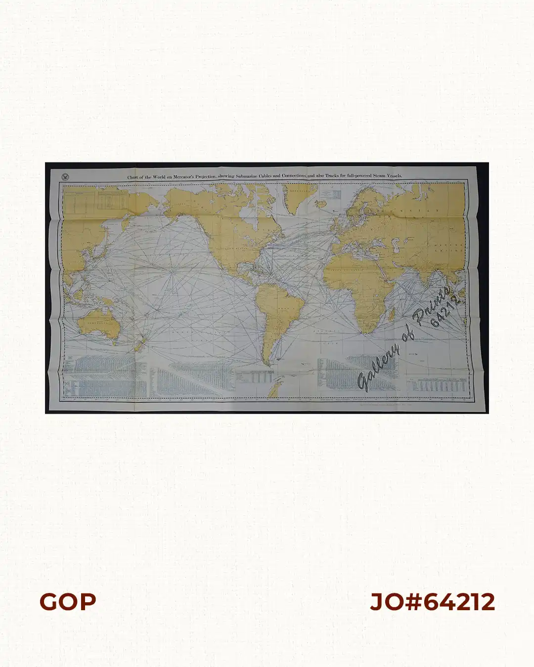
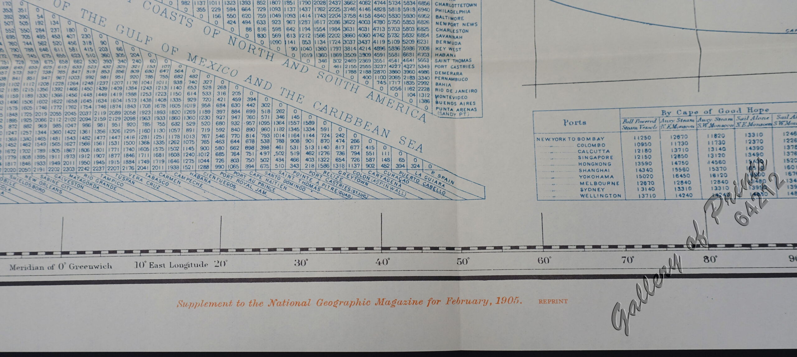
Vintage Reprint of the large World map of the 1905 edition. Prepared under the direction of the Hyrdographic Office.
Submarine cables have played an important part in the development of world-wide communications since the 1850’s. National Geographic first charted these cables in 1896. In comparison to that earlier map, this map reveals the explosion of communications infrastructure worldwide at the beginning of the last century.
attached to the book – see SKU# 12615
![Islas de Infanta y Polillo pl. 12 [Quezon Prov., Polilio Is., Pananongan I., Jomalig I.]](https://galleryofprints.shop/wp-content/uploads/2023/08/JO62585-Algue-1900-Quezon-Province-Polilo-Jomalig-Patnanongan-scaled-1-600x750.webp)
![Plan des principaux ports de la côte d'Illocos … [Map of the Principal Ports of the Ilocos Coast]](https://galleryofprints.shop/wp-content/uploads/2024/07/JO62314c-Mannevillette-1775-Plan-des-principaux-ports-scaled-1-600x750.webp)