Home
About Us
Shops
Publications
Exhibits
Picture Hanging System
Tours
Blogs
Select Page
Home
/
/
Antique Prints of the Philippines
/
Cartography [Maps]
/ Chart of the East India Islands…
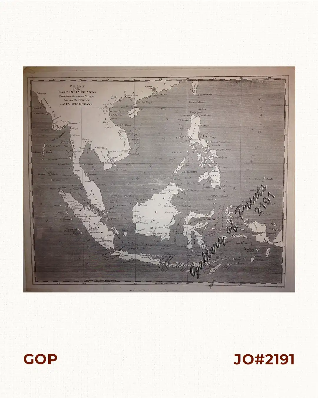
Chart of the East India Islands…
₱
6,600.00
1 in stock
Chart of the East India Islands... quantity
Add to cart
SKU:
2191
Category:
Cartography [Maps]
Tag:
Southeast Asia 5
Description
Condition
Description
An attractive steel engraved map.
Condition
Very good to excellent condition.
Related products
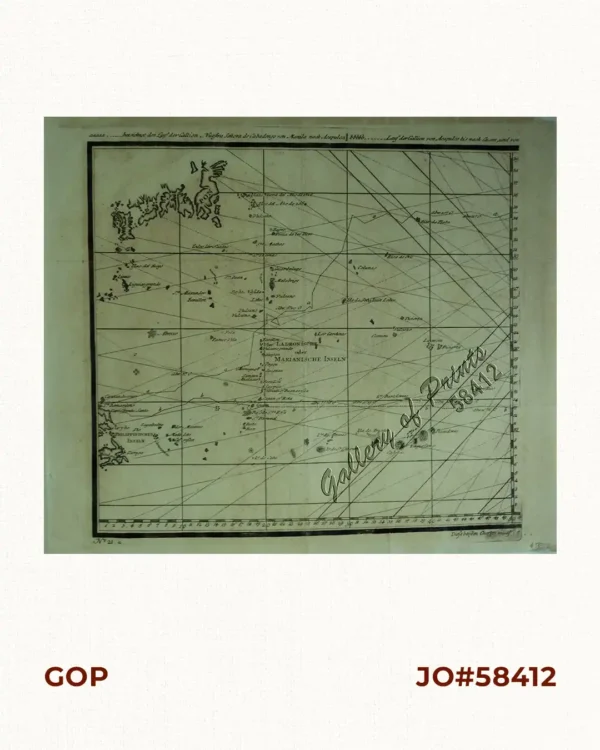
a) bezeichnet den Lauf der Gallion Nuestra Señora de Cabadongo von Manila nach Acapulco.; b) Lauf der Gallion von Acapulco bis nach Guam, und von da nach den Philippinischen Inseln, wo diese Gallion am 30 Jun. 1743 von dem Ober Befehlshaber Anson erobert ward.
₱
26,400.00
Plan des principaux ports de la côte d’Illocos … [Map of the Principal Ports of the Ilocos Coast]
₱
11,000.00
Islas de Infanta y Polillo pl. 12 [Quezon Prov., Polilio Is., Pananongan I., Jomalig I.]
₱
4,400.00
PRODUCT CATEGORIES
Advertisements
Antique Books about the Philippines
Antique Prints of the Philippines
Botany/Flora [Flowers/Fruits]
Cartography [Maps]
Costumes & People
Ichthyology [Fishes]
Ornithology [Birds]
Scripophily [Stock Certificates]
Views & Various [Philippines]
Zoology/Fauna [Animals]
Antiques
Articles
Modern Books [Other Countries]
Modern Books about the Philippines [after 1999]
Modern map
Natural Sciences Prints
Photographs
Prints
The Murillo 1734 Map of the Philippines – Reproduction
Uncategorized Items
Views & Various [Other Countries]
Vintage Books about the Philippines [1926-1999]
Vintage Prints/Maps/Views[1926-1999]
Shopping cart
0
There are no products in the cart!
Continue shopping
0
Products search
![Plan des principaux ports de la côte d'Illocos … [Map of the Principal Ports of the Ilocos Coast]](https://galleryofprints.shop/wp-content/uploads/2024/07/JO62314c-Mannevillette-1775-Plan-des-principaux-ports-scaled-1-600x750.webp)
![Islas de Infanta y Polillo pl. 12 [Quezon Prov., Polilio Is., Pananongan I., Jomalig I.]](https://galleryofprints.shop/wp-content/uploads/2023/08/JO62585-Algue-1900-Quezon-Province-Polilo-Jomalig-Patnanongan-scaled-1-600x750.webp)