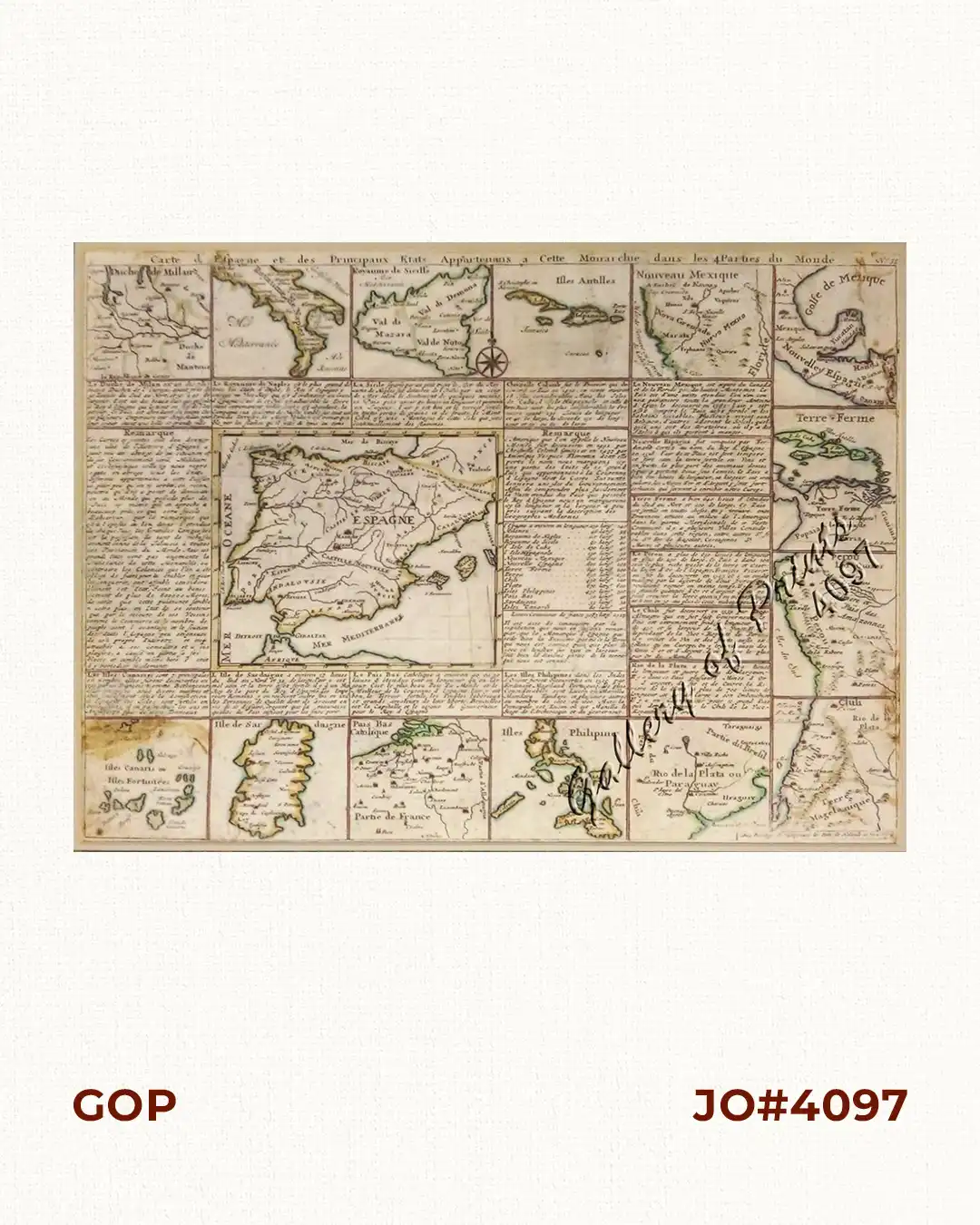
Description
hand-coloured copper engraving. The RARE First state map from the ‘Atlas historique….’, no. 38, of vol 1.
Originally 1, then extended to 7 volumes.
The colonial power SPAIN is shown in the centre surrounded by small depictions of all Possessions throughout the world, supported by geographical and historical text for each map.
![Isla de Luzon pl. 10, inset: Pto. de Banacalan [Marinduque] (Quezon [or Tayabas], Camarines Norte, Marinduque, Balegin [Balesin], Calbalete [Cagbalete]… )](https://galleryofprints.shop/wp-content/uploads/2023/08/JO64134-Algue-1900-Isla-de-Luzon-scaled-1-600x750.webp)