Description
hand-coloured copper engraving. EXTREMELY RARE collector’s prize.
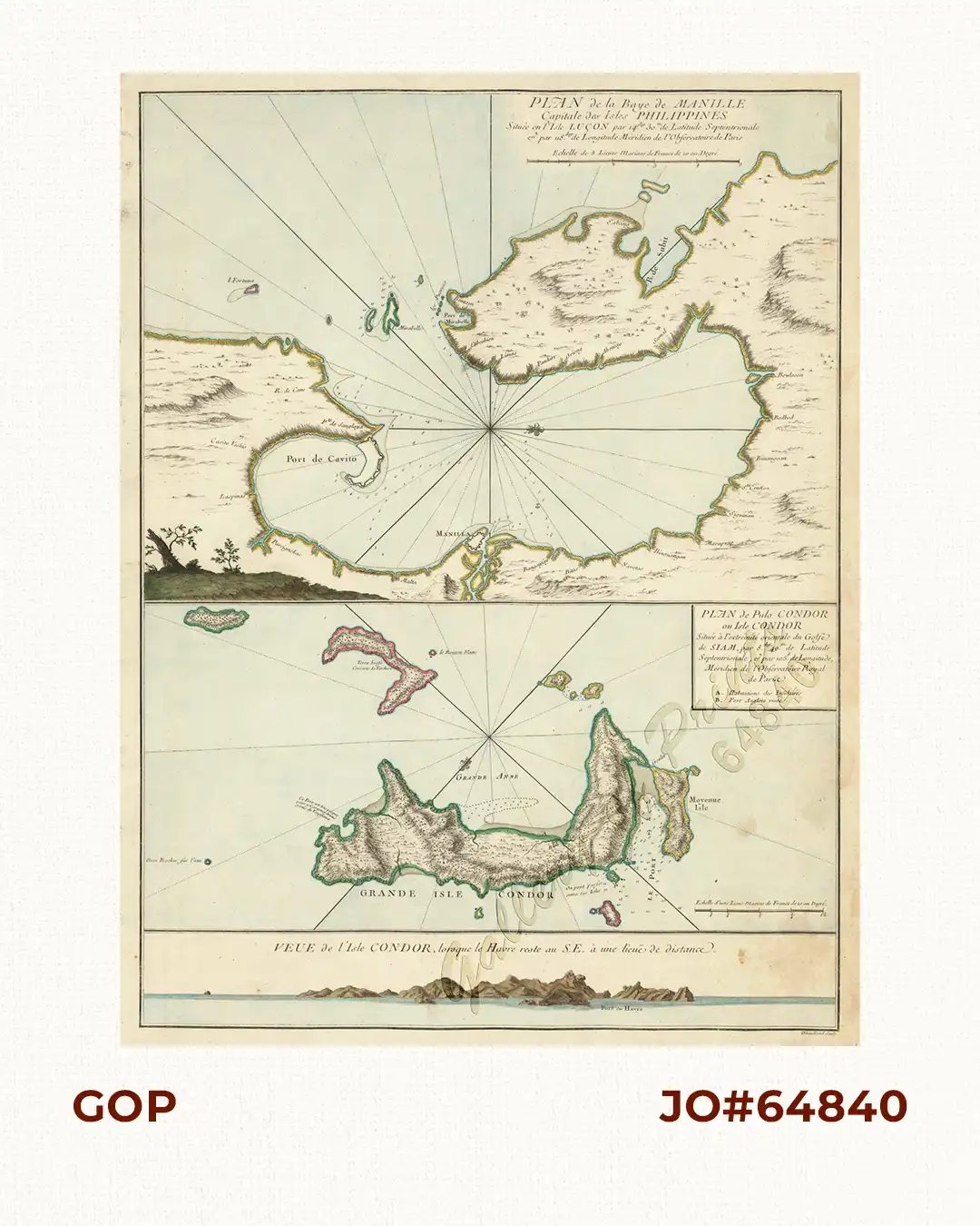
This is the rarest map of Manila Bay of the 18th Century, as it was only included with the extremely rare First Edition of ‘Le Neptune Oriental’. Only the first edition of this French atlas of large Sea Charts included this one chart of Manila Bay by the Master Engraver Dheulland ; the second edition offers a different image. The same sheet shows a map and a panoramic view of Côn Son Island, off South Vietnam., The chart of Manila Bay is orientated to the East and encompasses the entire coastal area from Cavite to the city of Manila and as far north as Subic Bay.
Jean-Baptiste-Nicolas-Denis D’Après de Mannevillette (1707-1780) was a famous French sailor and hydrographer. During a voyage to China in 1728 he succeeded in correcting the latitudes of many places using new instruments. Back in France he devised a plan to correct and publish all the existing maps of the route to China.
![Typus freti Manilensis detroit de Manilles [Straits of Manila]](https://galleryofprints.shop/wp-content/uploads/2015/05/JO54051-Renneville-1725-Philippines-Manila-Samar-Mindoro-Luzon-scaled-1-600x750.webp)
![Les Isles Philippines, celle de Formose, le Sud de la Chine, les Royaumes de Tunkin, de Cochinchine, de Camboge, de Siam, des Laos… inset: 1) Isle de Guam. 2) [Isles Marianes]](https://galleryofprints.shop/wp-content/uploads/2015/06/JO61653-Bonne-1778-Les-Isles-Philippines-scaled-1-600x750.webp)