Description
copper engraving. EXTREMELY RARE.
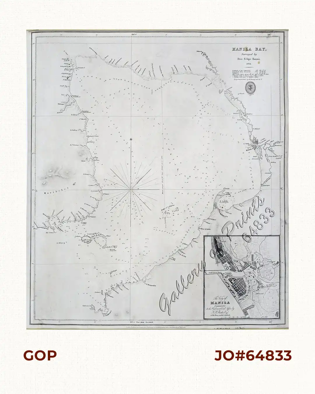
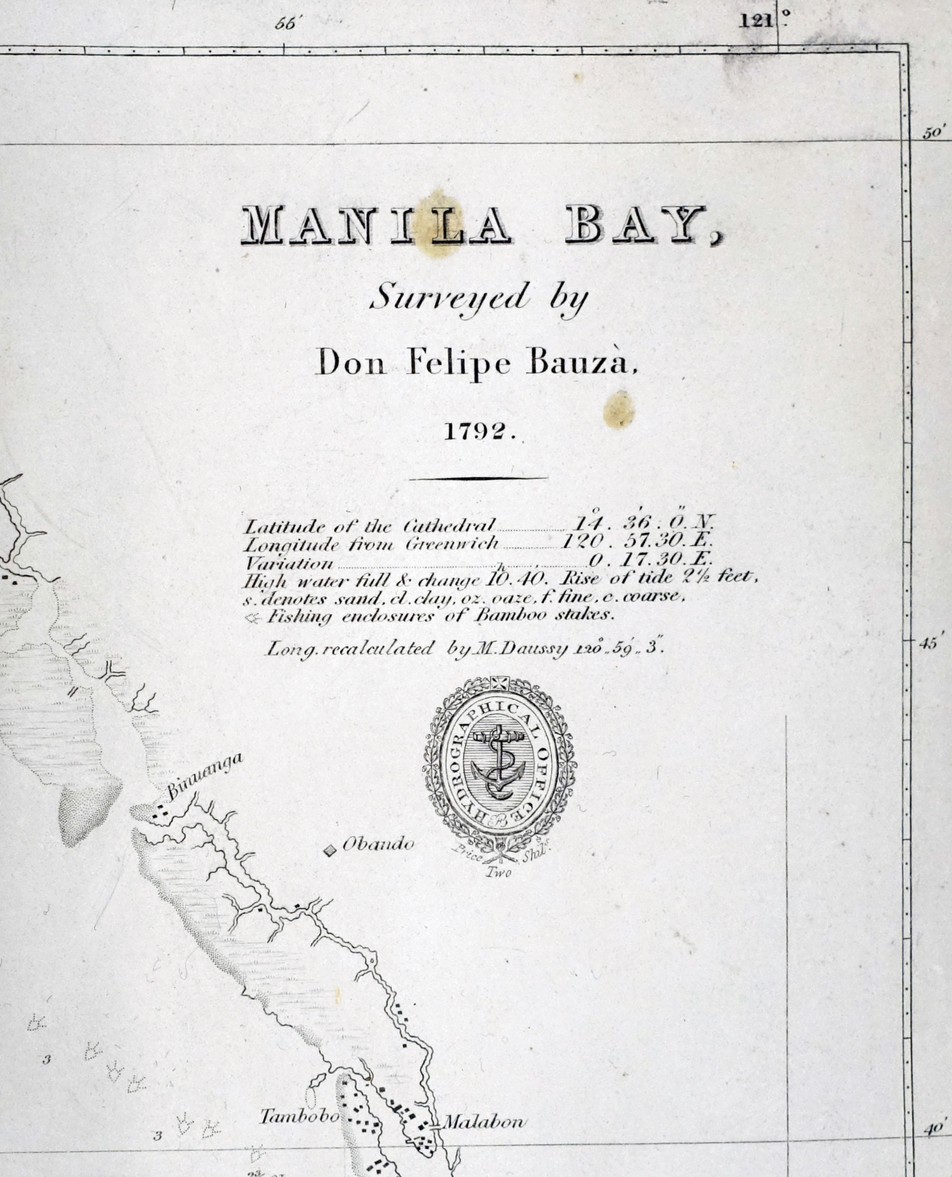
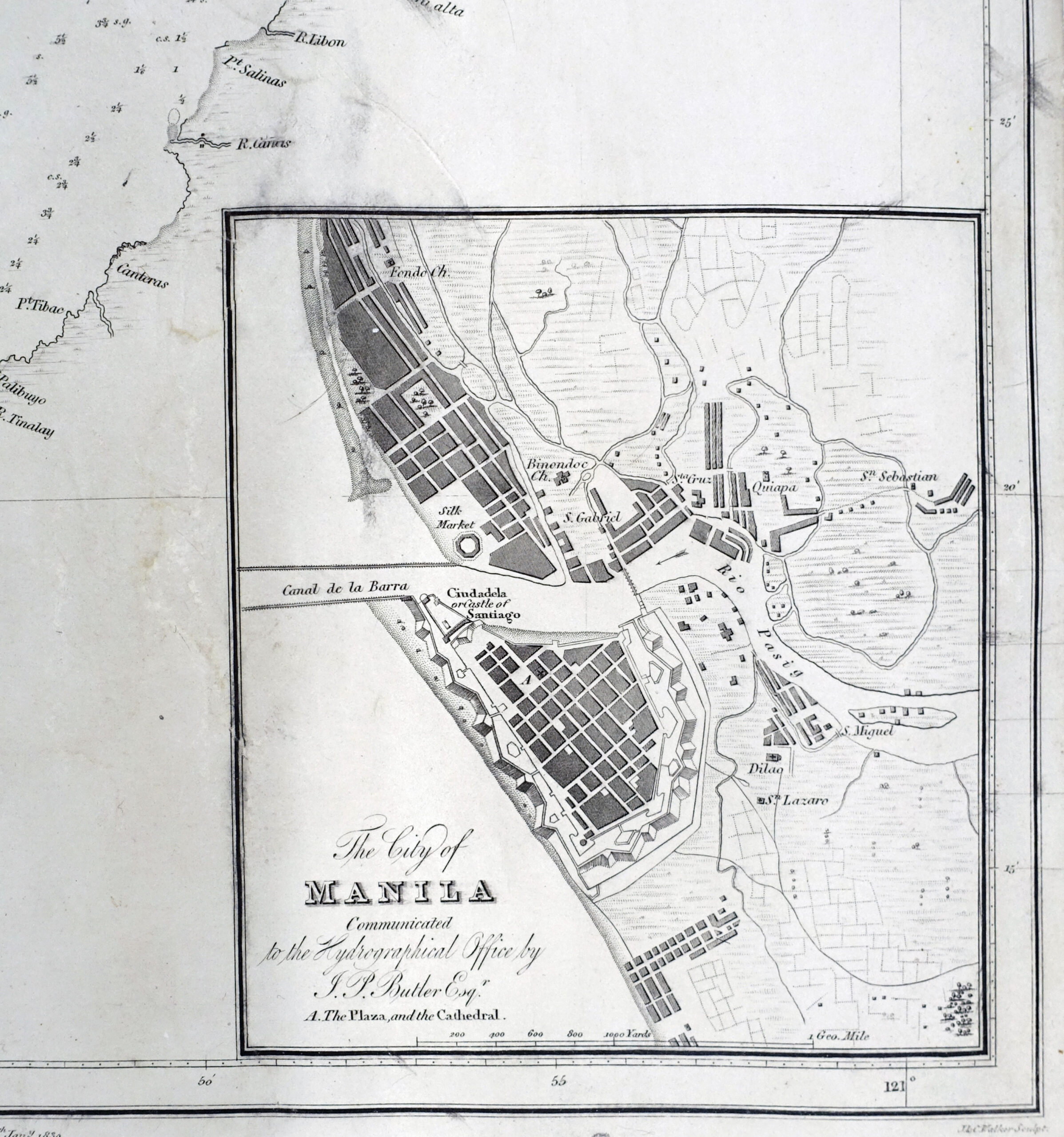
Seminal Bauza chart of Manila Bay published according to “Act of Parliament” at the Hydrographical Office of the Admiralty 25th January 1830, London, and subsequently (in 1839) given the chart number 976; this is the chart used and copied – as here – repeatedly by many institutions and seafarers of subsequent decades. Even this particular uptake by the British is highly collectible.
Felipe Bauzá y Cañas (1764–1834) was a Spanish naval officer, hydrographer, and cartographer. He was the main cartographer of the Malaspina Expedition to the Americas, Oceania and Australasia between 1789 and 1794, and Bauza Island in New Zealand is named after him. At the end of that expedition he travelled across South America by land and created a map of the Andes.