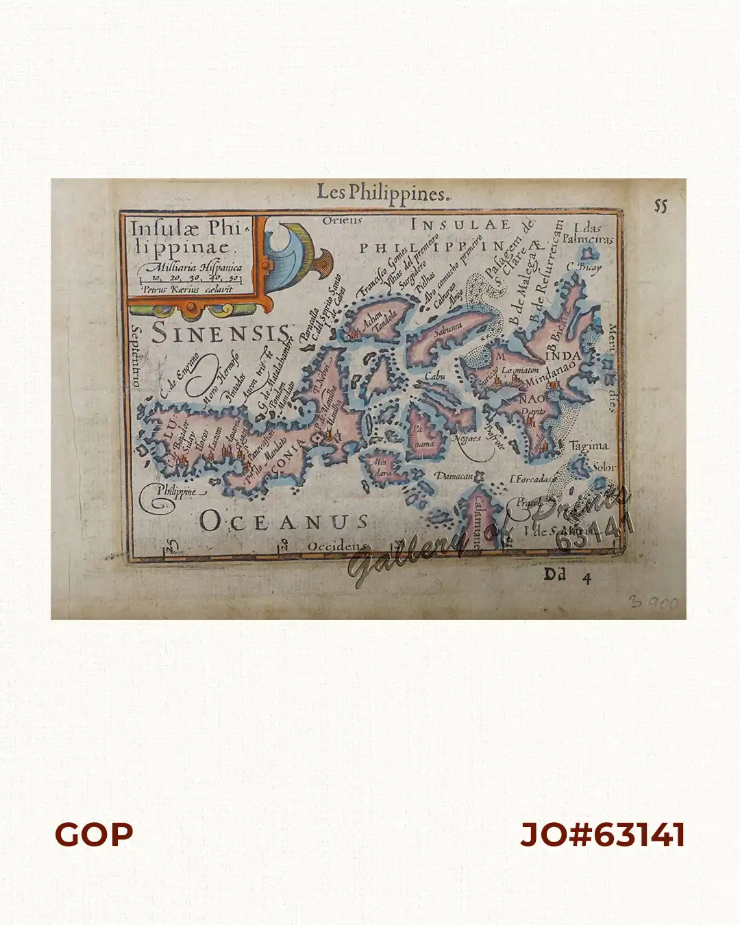
Description
hand-coloured copper engraving, EXTREMELY RARE, from the pocket atlas ‘Tresor des cartes…’[Treasure Chest of Maps…]; chapter: ‘Les Philippines’, 2 vols.; vol. 2, p. 55-56, French edition; published by A. Henry La Haye. THIS IS THE FIRST PRINTED MAP SOLELY SHOWING THE PHILIPPINES. Essentially taken from Plancius’ “spice map” “Insulae Moluccae …” of 1592, and van Linschoten’s “Exacta & accurata delineatio cum oranum maritimarum…” of 1595. It helped to define “The Philippines” as ONE country.
Kaerius (Pieter van den Keere, 1571-1646) was one of many Flemish refugees who fled from religious persecution in the Low Countries (Netherlands, Belgium, etc.) between 1570-1590. He moved to London with his sister, who married Jodocus Hondius, the famous cartographer, from whom Kaerius must have learned his skills as an engraver & cartographer. Koeman distinguishes two atlases: The “original” ‘Caert-thresoor’, published by Langenes and Claesz., with 5 editions from 1598-1609; and the ‘Tabularum Geographicarum Contractarum’ by Petrus Bertius with 10 editions from 1600-1650.
![Cynometra Cauliflora. L. [Indonesia: Nam-nam; English translation"flowers on the stem"]](https://galleryofprints.shop/wp-content/uploads/2017/03/JO60546-Hoola-600x750.webp)