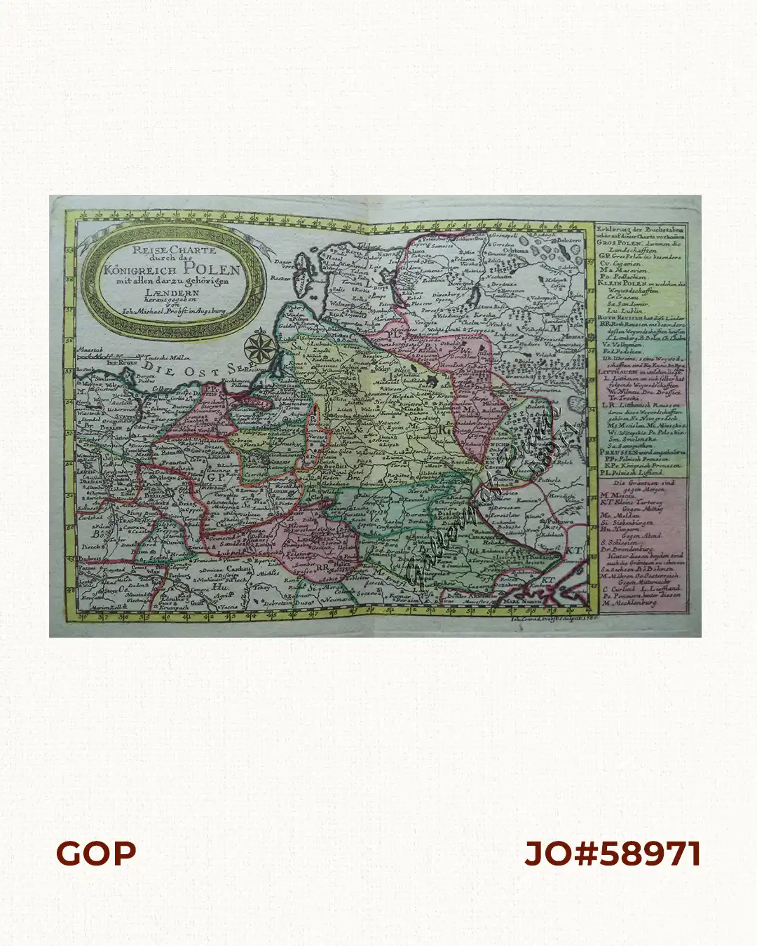
Description
RARE original hand-colour copper engraving, double-page chart map of Poland with oval cartouche, an explanatory text and directory on the right of the map, from the “Atlas Minor ex Tabulis Geographicis…” [without plate no.]. Map engraved in 1786 as shown in lower right.
![Typus freti Manilensis detroit de Manilles [Straits of Manila]](https://galleryofprints.shop/wp-content/uploads/2015/05/JO54051-Renneville-1725-Philippines-Manila-Samar-Mindoro-Luzon-scaled-1-600x750.webp)
![Isla de Luzon pl. 10, inset: Pto. de Banacalan [Marinduque] (Quezon [or Tayabas], Camarines Norte, Marinduque, Balegin [Balesin], Calbalete [Cagbalete]… )](https://galleryofprints.shop/wp-content/uploads/2023/08/JO64134-Algue-1900-Isla-de-Luzon-scaled-1-600x750.webp)
![Plan des principaux ports de la côte d'Illocos … [Map of the Principal Ports of the Ilocos Coast]](https://galleryofprints.shop/wp-content/uploads/2024/07/JO62314c-Mannevillette-1775-Plan-des-principaux-ports-scaled-1-600x750.webp)
![Die Weltfahrt der k. k. Fregatte Novara: Marktscene aus Manila. Nach einer Zeichnung von J. Selleny. [Circumnavigation of the Imperial and Royal Frigate Novara: Market Scene in Manila.] After a Drawing by J. Selleny.] Spanische Mestize [Spanish Mestizo] Tagalischer Mestize [Tagalog Mestizo] Chinesisch=tagalische Mestize [Chinese = Tagalog Mestizo] Reine Tagalin [Pure Tagalog] Vollblutchinesin [Full-blooded Chinese]](https://galleryofprints.shop/wp-content/uploads/2025/11/JO64827e-von-Scherzer-1859-Marktscene-aus-Manila-coloured-600x750.webp)