Description
copper engraving.
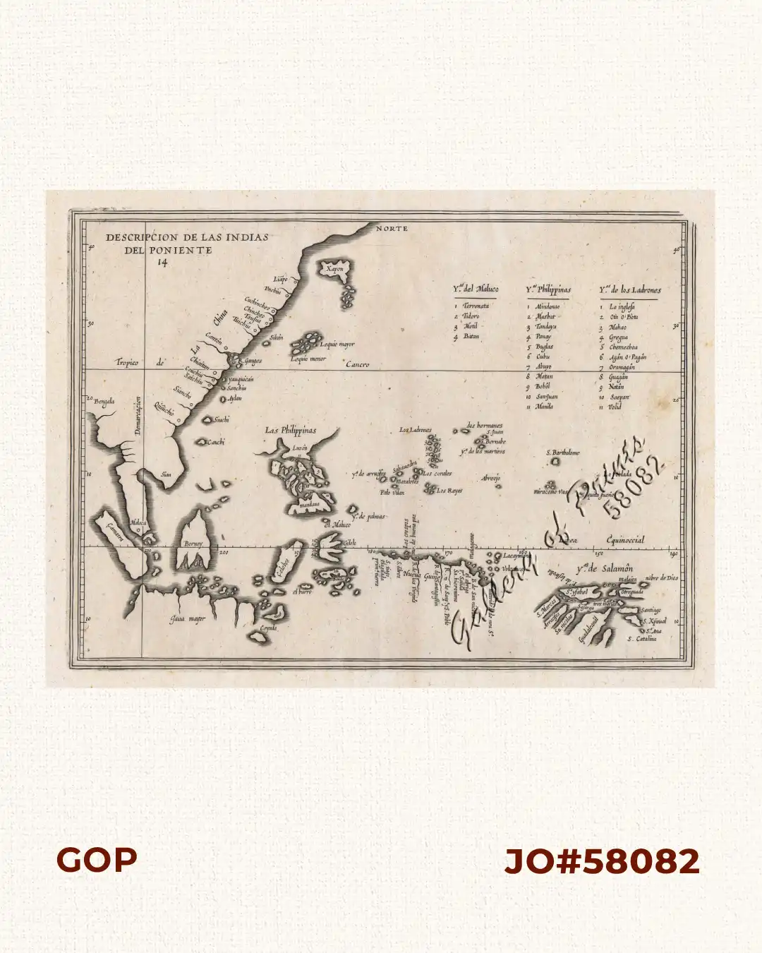
EXTREMELY RARE map from “Descripcion de las Islasoccidentales, Historia General, da. 314, 2nd. Ed. The 1st ed. published in 1601 in Madrid;Herrera (1559-1625), a writer & official historian to the King of Spain, compiled a history of the Indies accompanied by maps of the West Indies & Central & South America. The 1st ed. was re-issued in several editions & languages, the most important of which were in 1622. On this map, Luzon is notshown as an island, only as an outline; other Phil. islands are named, incl.his own “creation” : San Juan (St. John), the imaginary island to become so “notorious” in future maps till even the 19th century.
![Islas de Infanta y Polillo pl. 12 [Quezon Prov., Polilio Is., Pananongan I., Jomalig I.]](https://galleryofprints.shop/wp-content/uploads/2023/08/JO62585-Algue-1900-Quezon-Province-Polilo-Jomalig-Patnanongan-scaled-1-600x750.webp)
![Typus freti Manilensis detroit de Manilles [Straits of Manila]](https://galleryofprints.shop/wp-content/uploads/2015/05/JO54051-Renneville-1725-Philippines-Manila-Samar-Mindoro-Luzon-scaled-1-600x750.webp)